Splashpoint
Uploader's Comments
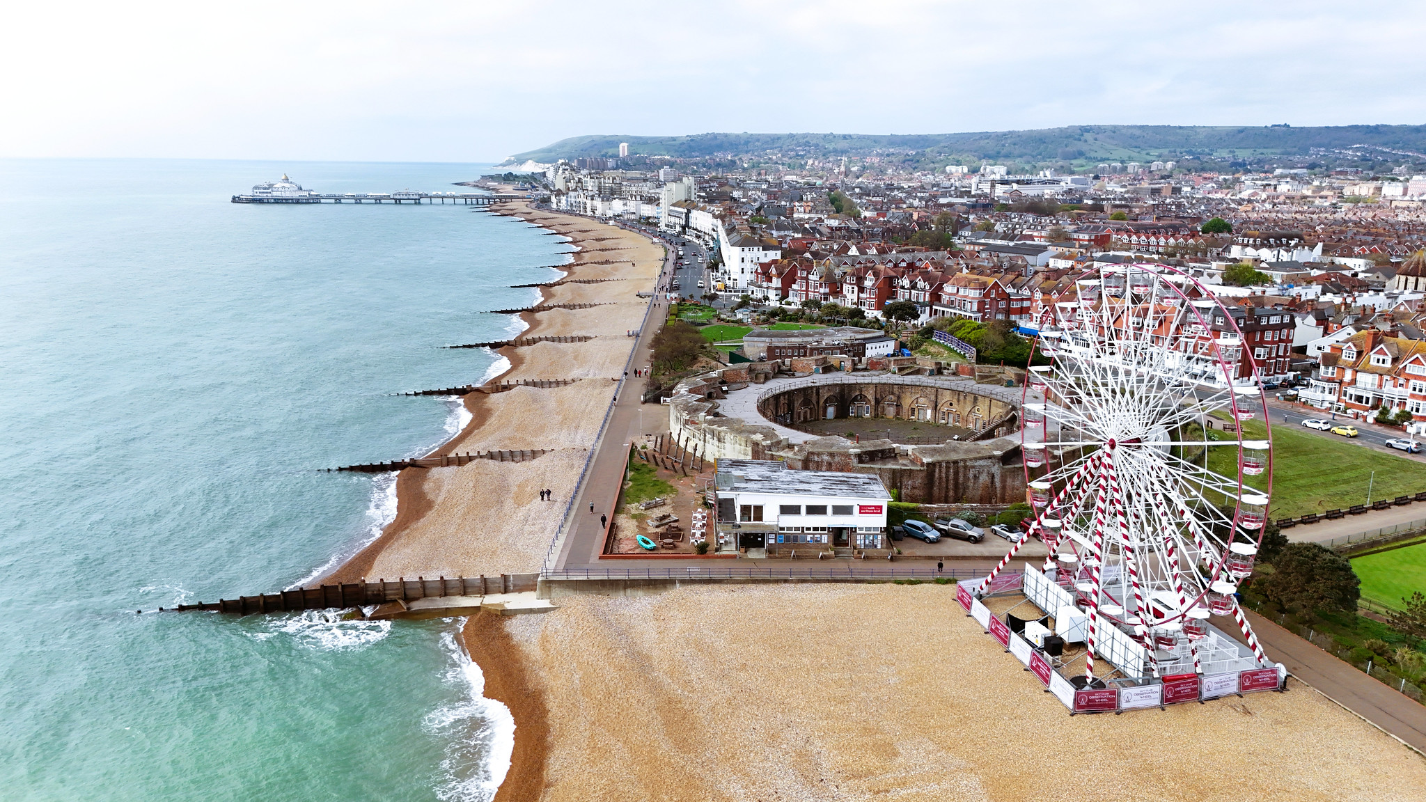
Eastbourne Redoubt Fortress, the Big Wheel, the Pier and the South Downs in the background.
Uploaded to Flickr by Wooly Matt on 27 April 2025
Eastbourne Redoubt Fortress, the Big Wheel, the Pier and the South Downs in the background.
Uploaded to Flickr by Wooly Matt on 27 April 2025
 Photo © Wooly Matt, 27 April 2025.
Licensed for reuse under this Creative Commons licence
Photo © Wooly Matt, 27 April 2025.
Licensed for reuse under this Creative Commons licence
Location: Roselands, Eastbourne
Location type: Urban
OS Grid: TV625998
Coordinates: 50°46'31"N 0°18'13"E
Mapcode: GBR MV8.CL4
What 3 Words: slices.pursue.highlight
Coordinates and location codes are for an approximate mid-point of the beach, and may not reflect the best access point or the most popular part of the beach.
County: East Sussex
Country: England
Local Authority: Eastbourne
Nearest postcode: BN22 7LA
(for sat-nav purposes only, a beach does not have a postal address!)