Approximate Location Map
Use two fingers to pan or zoom the map
Use two fingers to pan or zoom the map
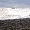
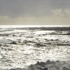
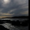
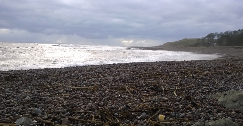
Inverbervie Beach is situated within Bervie Bay and follows the curved coastline from a position in front of the small town of Inverbervie. The beach is composed of pebbles and shingles, and its northern end features the river mouth of Bervie Water, which flows into the bay. This location is popular among fishing enthusiasts.
The beach has a car park and picnic tables, conveniently located next to it at the end of Kirk Burn. A coastal path passes the beach, providing excellent views of the rugged coastline in both directions. Visitors can also explore the town of Inverbervie, which offers a range of facilities, including shops, places to eat, and a sports centre. Notably, The Bervie Chipper, an award-winning fish and chip shop, is a popular destination for food.
Bay Shingle Pebbles
| Today | |
|---|---|
| Chance of rain | 91% |
| Max temperature | 15°C |
| feels like | 15°C |
| Wind 9mph | |
| Max UV Index |
| Tonight | |
|---|---|
| Chance of rain | 97% |
| Min temperature | 10°C |
| feels like | 10°C |
| Wind 10mph |
The tide at Inverbervie Beach is currently falling. Low tide will be at approximately 10:40 AM, and the next high tide will be at approximately 5:08 PM.
![]() Today's air pollution levels are forecast to be Low
Today's air pollution levels are forecast to be Low
Parking available next to the beach.
Dogs are allowed.
No lifeguard cover at this beach
Water quality not measured here
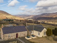
Angus Council Farm Cottage

From £313.00 per week at Holidaycottages.co.uk
Romantic Angus Council Cottage
From £339.00 per week at Holidaycottages.co.uk
Dunnottar Woods House

From £1856.00 per week at Sykes Holiday Cottages
Romantic Angus Council Cottage

From £511.00 per week at Holidaycottages.co.uk
Courtyard Cottage

From £2635.00 per week at Sykes Holiday Cottages
North Stables - House Of Dun

From £2457.00 per week at Sykes Holiday Cottages
Maggie Law Maritime Museum (1.1 miles)
Harbour Bar, Gourdon (1.1 miles)
Sup2Summit (1.1 miles)
All distances are approximate
around 7 miles southwest as the seagull flies, around 8 miles by road.
around 9 miles north-northeast as the seagull flies, around 10 miles by road.
around 9 miles north-northeast as the seagull flies, around 11 miles by road.
around 11 miles southwest as the seagull flies, around 14 miles by road.
around 13 miles north-northeast as the seagull flies, around 16 miles by road.
around 16 miles south-southwest as the seagull flies, around 19 miles by road.
around 22 miles north-northeast as the seagull flies, around 27 miles by road.
around 23 miles south-southwest as the seagull flies, around 26 miles by road.
around 23 miles north-northeast as the seagull flies, around 27 miles by road.
around 24 miles south-southwest as the seagull flies, around 26 miles by road.
around 27 miles south-southwest as the seagull flies, around 31 miles by road.
around 28 miles southwest as the seagull flies, around 33 miles by road.
around 29 miles southwest as the seagull flies, around 33 miles by road.
around 30 miles north-northeast as the seagull flies, around 40 miles by road.
Location: Inverbervie
Location type: Village
OS Grid: NO833723
Coordinates: 56°50'32"N 2°16'27"W
Mapcode: GBR XG.TN0F
What 3 Words: thousands.pictures.marmalade
Coordinates and location codes are for an approximate mid-point of the beach, and may not reflect the best access point or the most popular part of the beach.
Country: Scotland
Local Authority: Aberdeenshire
Nearest postcode: DD10 0QZ
(for sat-nav purposes only, a beach does not have a postal address!)
Important! Beach information is compiled from a variety of different sources and is correct to the best of our knowledge at the time of compilation. However, information may be incorrectly supplied by our sources or go out of date after publication. BritishBeaches.uk makes no warranty as to the accuracy of any information on this page.
(Or après-beach. Or pre-beach. Or, just because you might want stuff)
Men's Tops
Weird Fish Rachel Printed Jersey T-Shirt Night Blue Size 8

Only £17.50 from Weird Fish