Approximate Location Map
Use two fingers to pan or zoom the map
Use two fingers to pan or zoom the map
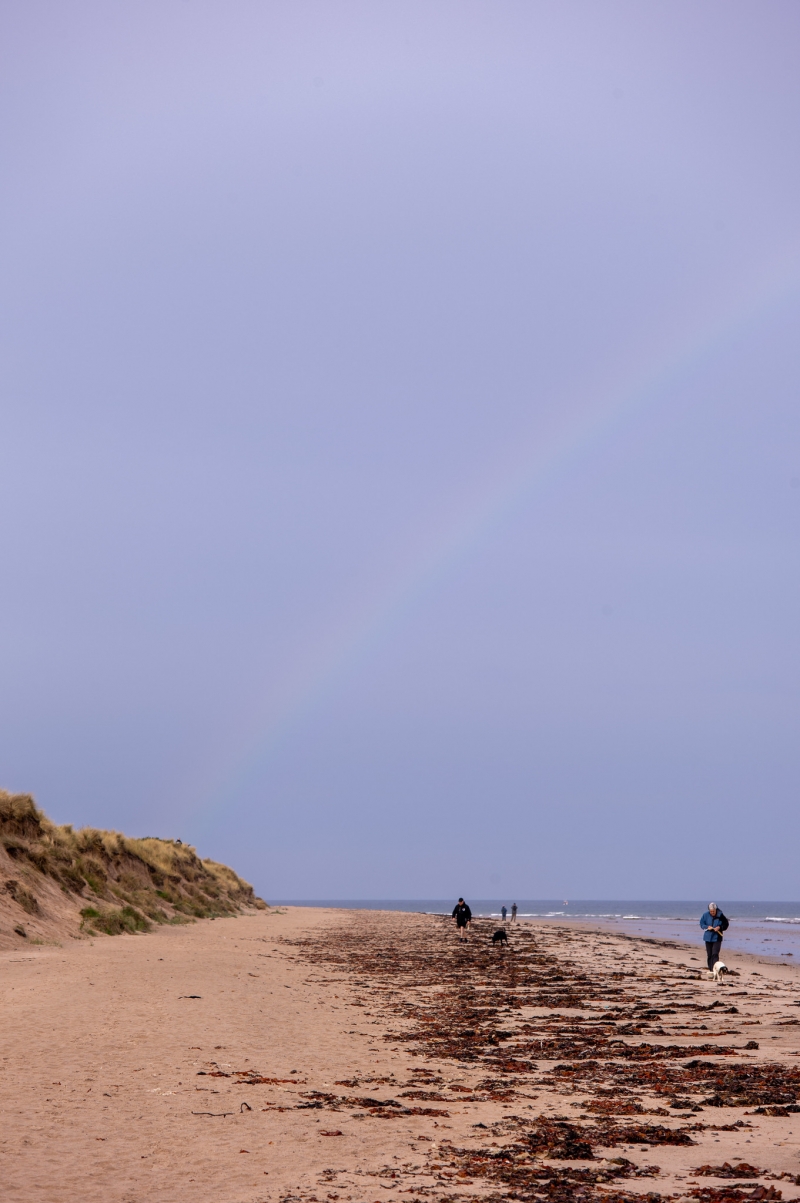
Lossiemouth Silversands is a sandy beach interspersed with rocks, offering fine views out over the Moray Firth and towards Spey Bay. The beach is situated near several notable landmarks, including the rocks of Little Skerries and Halliman Skerries, which can be seen offshore at low tide. Behind the beach, beyond the dunes, lies a caravan park, two golf courses, and the towers of Gordonstoun School, where Prince Charles was educated.
The beach is popular with surfers, horse riders, and sailing craft. The Moray Firth is a good place to spot dolphins, as well as many birds and seals that frequent this area. The proximity of the Gulf Stream ensures that this area of Scotland has some of the mildest and driest weather in the whole of the United Kingdom. Visitors can enjoy good walking country, with plenty of trails and footpaths passing close by, including the Moray Coast Trail.
A short walk in a westerly direction will bring visitors to the Covesea Lighthouse, which was completed in 1846 and manned until 1984. Today, pre-arranged guided tours of the lighthouse can be arranged for some Saturday mornings from Easter until the end of October. The nearby town of Lossiemouth has a museum, a marina, and a good range of cafes, restaurants, and places to stay. For aircraft lovers, the proximity of RAF Lossiemouth ensures that the frequent roar of powerful aircraft is a regular feature along this part of the beautiful Moray coast. Food and facilities are also available to the east in Branderburgh.
Lossiemouth Silversands is adjacent to the Moray Coast Trail.
Sand
| Today | |
|---|---|
| Chance of rain | 85% |
| Max temperature | 15°C |
| feels like | 16°C |
| Wind 12mph | |
| Max UV Index |
| Tonight | |
|---|---|
| Chance of rain | 95% |
| Min temperature | 11°C |
| feels like | 11°C |
| Wind 14mph |
The tide at Lossiemouth Silversands is currently falling. Low tide will be at approximately 9:00 AM, and the next high tide will be at approximately 3:24 PM.
![]() Today's air pollution levels are forecast to be Low
Today's air pollution levels are forecast to be Low
Parking available close to this beach, just on the outskirts of Branderburgh.
Dogs are allowed
No lifeguard cover at this beach
Water quality not measured here
Romantic Quirky Moray Cottage

From £441.00 per week at Holidaycottages.co.uk
Enzie Station Cottage

From £2021.00 per week at Sykes Holiday Cottages
The Neuk

From £1434.00 per week at Sykes Holiday Cottages
Holly Hoose

From £2298.00 per week at Sykes Holiday Cottages
Wee Wickie

From £2321.00 per week at Sykes Holiday Cottages
The Farm Steading

From £1561.00 per week at Sykes Holiday Cottages
Moray Golf Club (1 miles)
Covesea Links Golf Course (1.4 miles)
Covesea Lighthouse Lossiemouth (1.4 miles)
Lossiemouth Fisheries and Community Museum (1.5 miles)
North 58 Sea Adventures (1.6 miles)
Duffus Castle (2.9 miles)
Millbuies Trout Fishery, Moray Fly Fishers (3.4 miles)
Spynie Palace (3.5 miles)
The Moray Coast Trail 'C' - Hopeman to Burghead (4 miles)
All distances are approximate
around 2 miles east-southeast as the seagull flies, around 3 miles by road or 2 miles on foot using coastal paths.
around 4 miles west-southwest as the seagull flies, around 5 miles by road.
around 7 miles west-southwest as the seagull flies, around 7 miles by road.
around 11 miles west-southwest as the seagull flies, around 15 miles by road.
around 15 miles east as the seagull flies, around 25 miles by road.
around 15 miles east as the seagull flies, around 26 miles by road.
around 18 miles east as the seagull flies, around 27 miles by road.
around 21 miles east as the seagull flies, around 31 miles by road.
around 29 miles east as the seagull flies, around 40 miles by road.
around 30 miles east as the seagull flies, around 42 miles by road.
around 20 miles west-northwest as the seagull flies, around 82 miles by road.
around 22 miles west-southwest as the seagull flies, around 26 miles by road.
around 22 miles west as the seagull flies, around 78 miles by road.
around 22 miles west-southwest as the seagull flies, around 26 miles by road.
around 27 miles west as the seagull flies, around 67 miles by road.
around 28 miles northwest as the seagull flies, around 98 miles by road.
around 28 miles west-northwest as the seagull flies, around 84 miles by road.
around 28 miles west-northwest as the seagull flies, around 87 miles by road.
around 28 miles west-northwest as the seagull flies, around 85 miles by road.
around 30 miles northwest as the seagull flies, around 92 miles by road.
Location: Stotfield,
Location type: Village
OS Grid: NJ213711
Coordinates: 57°43'24"N 3°19'18"W
Mapcode: GBR L859.M43
What 3 Words: shifters.slogans.curable
Coordinates and location codes are for an approximate mid-point of the beach, and may not reflect the best access point or the most popular part of the beach.
Country: Scotland
Local Authority: Moray
Nearest postcode: IV31 6SP
(for sat-nav purposes only, a beach does not have a postal address!)
Important! Beach information is compiled from a variety of different sources and is correct to the best of our knowledge at the time of compilation. However, information may be incorrectly supplied by our sources or go out of date after publication. BritishBeaches.uk makes no warranty as to the accuracy of any information on this page.
(Or après-beach. Or pre-beach. Or, just because you might want stuff)
Men's Tops
Weird Fish Shorling 1/4 Zip Striped Macaroni Sweatshirt Black Size 5XL

Only £51.00 from Weird Fish

