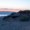
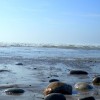
Porth Neigwl

Uploader's Comments
With a trapezoidal concrete wall which is one of the upstanding remains of RAF Hell's Mouth, decommissioned 1945.
Uploaded to Flickr by itmpa on 27 July 2019
With a trapezoidal concrete wall which is one of the upstanding remains of RAF Hell's Mouth, decommissioned 1945.
Uploaded to Flickr by itmpa on 27 July 2019
 Photo © itmpa, 27 July 2019.
Licensed for reuse under this Creative Commons licence
Photo © itmpa, 27 July 2019.
Licensed for reuse under this Creative Commons licence
Location: Llanengan
Location type: Rural
OS Grid: SH280265
Coordinates: 52°48'31"N 4°33'9"W
Mapcode: GBR 54.W4K1
What 3 Words: plan.fond.bland
Coordinates and location codes are for an approximate mid-point of the beach, and may not reflect the best access point or the most popular part of the beach.
Country: Wales
Local Authority: Gwynedd
Parish: Llanengan
Nearest postcode: LL53 7LS
(for sat-nav purposes only, a beach does not have a postal address!)