Approximate Location Map
Use two fingers to pan or zoom the map
Use two fingers to pan or zoom the map
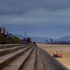
Swansea County Hall Beach is part of the extensive sand and mud flats that make up Swansea Bay. The beach is situated closest to the mouth of the River Tawe and the West Pier. It is backed by a promenade and marina, with residential flats and the Swansea Central Library nearby.
The beach is easily accessible, with parking available at the Civic Centre public car park. The vibrant city centre, with its shops, eateries, and other amenities, is just a short walk away.
Swansea Bay, which includes Swansea County Hall Beach, stretches from the Maritime Quarter around the bay to Mumbles. The beach offers a mix of sandy and muddy areas, and is a popular spot for watersports, with Swansea Bay being recognised as a Watersports Centre of Excellence.
The beach is surrounded by various amenities, including shops, restaurants, and a coastal park near the Swansea West Pier and Marina. Walking towards Mumbles, the beach is backed by the Singleton Park Boating Lake and a 'FootGolf' course.
Swansea County Hall Beach is adjacent to the Wales Coast Path.
Bay Sand Mud
| Tonight |  |
|---|---|
| Chance of rain | 63% |
| Min temperature | 13°C |
| feels like | 13°C |
| Wind 11mph |  |
| Tomorrow |
 |
|---|---|
| Chance of rain | 66% |
| Max temperature | 14°C |
| feels like | 18°C |
| Wind 18mph |  |
| Max UV Index |  |
The tide at Swansea County Hall Beach is currently falling. Low tide will be at approximately 10:30 PM, and the next high tide will be at approximately 4:38 AM tomorrow.
 Today's air pollution levels are forecast to be Low
 Food available
 Toilets
 Shops
Shops
 Litter bins
Swansea Civic Centre Car Park is by the beach.
Restrictions apply: http://www.swansea.gov.uk/dogsonbeaches
No lifeguard cover at this beach

Good water quality
less than a mile east-northeast as the seagull flies, less than a mile by road or less than a mile on foot using coastal paths.
around 2 miles west-southwest as the seagull flies, around 2 miles by road.
around 2 miles west-southwest as the seagull flies, around 3 miles by road.
around 3 miles east as the seagull flies, around 4 miles by road.
around 3 miles southwest as the seagull flies, around 3 miles by road.
around 3 miles southwest as the seagull flies, around 4 miles by road.
around 3 miles east as the seagull flies, around 4 miles by road.
around 3 miles south-southwest as the seagull flies, around 5 miles by road.
around 3 miles south-southwest as the seagull flies, around 5 miles by road.
around 3 miles south-southwest as the seagull flies, around 6 miles by road.
around 4 miles east as the seagull flies, around 5 miles by road.
around 4 miles south-southwest as the seagull flies, around 6 miles by road.
around 4 miles southwest as the seagull flies, around 5 miles by road.
around 5 miles southwest as the seagull flies, around 7 miles by road.
around 5 miles southwest as the seagull flies, around 6 miles by road.
around 5 miles east-southeast as the seagull flies, around 9 miles by road.
around 6 miles east-southeast as the seagull flies, around 10 miles by road.
around 6 miles southwest as the seagull flies, around 7 miles by road.
around 8 miles west-southwest as the seagull flies, around 10 miles by road.
around 8 miles west-southwest as the seagull flies, around 10 miles by road.
Location: Swansea
Location type: Urban
OS Grid: SS653921
Coordinates: 51°36'43"N 3°56'45"W
Mapcode: GBR WRK.VK
What 3 Words: wiring.slope.cove
Coordinates and location codes are for an approximate mid-point of the beach, and may not reflect the best access point or the most popular part of the beach.
Country: Wales
Local Authority: Swansea
Parish: Castle
Nearest postcode: SA1 3SL
(for sat-nav purposes only, a beach does not have a postal address!)
Important! Beach information is compiled from a variety of different sources and is correct to the best of our knowledge at the time of compilation. However, information may be incorrectly supplied by our sources or go out of date after publication. BritishBeaches.uk makes no warranty as to the accuracy of any information on this page.