Approximate Location Map
Use two fingers to pan or zoom the map
Use two fingers to pan or zoom the map
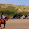
Three Cliffs Bay is a beautiful and picturesque beach situated to the east of Tor Bay. The beach boasts a wide expanse of golden sand backed by gently sloping dunes, and is easily recognisable by the limestone headland to the east with its iconic three summits. The bay is also home to Pennard Pill stream, which runs through the beach, and is encrusted with numerous rock pools.
The cliffs backing the beach are a popular spot for climbers, and the bay itself has been cited as both Britain's best beach and Britain's best view on separate occasions. The bay consists of several smaller beaches and coves, including Pobbles Bay to the east and Tor Bay to the west, which can be accessed on foot at low tide. At low tide, the beaches join up to form a great expanse of sand, and the bay also forms part of a wider bay which includes Oxwich Bay.
However, visitors should be aware that swimming in the bay can be hazardous due to strong rip currents, particularly at high tide. A seasonal lifeguard service is available, and it is only advisable to enter the water during this period. Access to the beach involves some rough terrain, including a scramble over the sand dunes, although a flatter route through the valley bottom from Parkmill is also available.
Visitors can still enjoy the sandy beach and its many rock pools to explore, especially at low tide. The limestone cliffs in the area are also a popular spot for climbers. Although there are no amenities or parking available, the village of Southgate is just a short walk away.
Bay Sand
| Today |  |
|---|---|
| Chance of rain | 34% |
| Max temperature | 12°C |
| feels like | 10°C |
| Wind 31mph |  |
| Max UV Index |  |
| Tonight |  |
|---|---|
| Chance of rain | 72% |
| Min temperature | 11°C |
| feels like | 7°C |
| Wind 18mph |  |
The tide at Three Cliffs Bay is currently rising. High tide will be at approximately 6:35 PM, and the next low tide will be at approximately 12:38 AM tomorrow.
Detailed weather and tides » Campsite
Limited car parking close by, or more parking at Oxwich.
Dogs are allowed: http://www.swansea.gov.uk/dogsonbeaches

Daily - 2nd July - 4th September
Weekends - 30th April - 2nd May; 7th - 22nd May; 11th - 26th June
Easter - 25th March - 10th April
May half term - 28th May - 5th June


Water quality not measured here
less than a mile west-southwest as the seagull flies, just over a mile by road or less than a mile on foot using coastal paths.
around 2 miles west-southwest as the seagull flies, around 4 miles by road or 3 miles on foot using coastal paths.
around 3 miles east as the seagull flies, around 6 miles by road or 4 miles on foot using coastal paths.
around 3 miles east as the seagull flies, around 6 miles by road or 4 miles on foot using coastal paths.
around 3 miles east as the seagull flies, around 6 miles by road.
around 4 miles west-southwest as the seagull flies, around 7 miles by road or 5 miles on foot using coastal paths.
around 4 miles east as the seagull flies, around 7 miles by road.
around 5 miles east-northeast as the seagull flies, around 7 miles by road.
around 5 miles east as the seagull flies, around 7 miles by road.
around 6 miles east-northeast as the seagull flies, around 7 miles by road.
around 6 miles east as the seagull flies, around 8 miles by road.
around 6 miles east as the seagull flies, around 8 miles by road.
around 6 miles east as the seagull flies, around 8 miles by road.
around 6 miles east as the seagull flies, around 8 miles by road.
around 6 miles east-northeast as the seagull flies, around 8 miles by road.
around 7 miles west as the seagull flies, around 9 miles by road.
around 8 miles north-northwest as the seagull flies, around 16 miles by road.
around 8 miles west as the seagull flies, around 10 miles by road.
around 8 miles east-northeast as the seagull flies, around 10 miles by road.
around 8 miles west as the seagull flies, around 10 miles by road.
Location: Penmaen
Location type: Rural
OS Grid: SS536879
Coordinates: 51°34'17"N 4°6'49"W
Mapcode: GBR GV.0WHY
What 3 Words: races.directive.diner
Coordinates and location codes are for an approximate mid-point of the beach, and may not reflect the best access point or the most popular part of the beach.
Country: Wales
Local Authority: Swansea
Parish: Ilston
Nearest postcode: SA3 2HD
(for sat-nav purposes only, a beach does not have a postal address!)
Important! Beach information is compiled from a variety of different sources and is correct to the best of our knowledge at the time of compilation. However, information may be incorrectly supplied by our sources or go out of date after publication. BritishBeaches.uk makes no warranty as to the accuracy of any information on this page.