Approximate Location Map
Use two fingers to pan or zoom the map
Use two fingers to pan or zoom the map
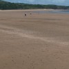
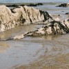
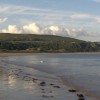
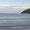
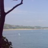
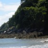
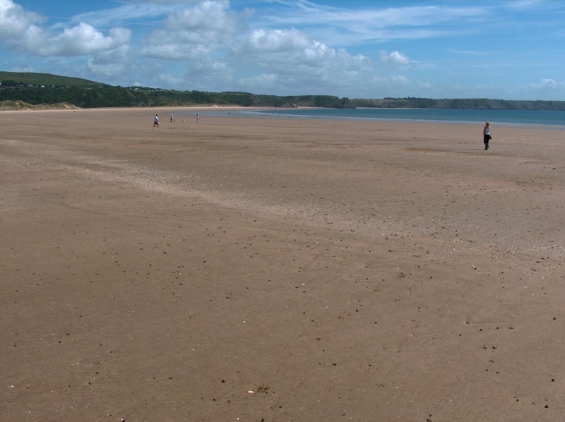
Oxwich Bay is a long, sandy beach with an adjacent Nature Reserve, providing a unique combination of recreational and conservation areas. The beach is situated on the south Gower Coast and is characterised by its long, wide, and sweeping stretch of golden sand, backed by sand dunes and a freshwater marsh. This marsh is a designated Site of Special Scientific Interest and a National Nature Reserve.
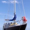
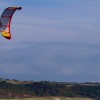
The beach is a popular destination for water sports, including sailing, water skiing, kayaking, paddleboarding, and windsurfing. A slipway provides access for launching boats, and a water taxi is available to Pwll Du and Pobbles. Visitors can also rent water sports equipment or take a jetski safari. For those who prefer to stay on land, the Oxwich Bay Circular Hike offers a scenic route that takes 2 to 3 hours to complete, allowing visitors to appreciate the coastal scenery and explore the surrounding woodlands and nature reserves.
The beach has a large car park directly behind it, providing ample parking spaces. There are also several places to eat, including a fish and chip shop, a beach hut selling snacks, and the Michelin-starred Beach House Restaurant for fine dining. The Oxwich Bay Hotel, which is also a wedding venue, offers casual dining options. Additionally, the beach is dog-friendly, allowing dogs to be on the beach all year round.
Oxwich Bay is a popular beach with families and can get quite busy towards the village end during the summer. However, the eastern section of the beach becomes more secluded and natural, backed by extensive sand dunes that form part of the nature reserve. This area is rarely busy, providing a peaceful retreat for those who want to escape the crowds.
Bay Sand
| Today | |
|---|---|
| Chance of rain | 100% |
| Max temperature | 15°C |
| feels like | 15°C |
| Wind 25mph | |
| Max UV Index |
| Tonight | |
|---|---|
| Chance of rain | 41% |
| Min temperature | 10°C |
| feels like | 11°C |
| Wind 24mph |
The tide at Oxwich Bay is currently rising. High tide will be at approximately 9:14 AM, and the next low tide will be at approximately 4:55 PM.
![]() Today's air pollution levels are forecast to be Low
Today's air pollution levels are forecast to be Low
There is a large car park by the beach.
Dogs are allowed: http://www.swansea.gov.uk/dogsonbeaches
Beach cleaned regularly.
No lifeguard cover at this beach
![]()
Excellent water quality
Romantic Rustic Powys Cottage

From £602.00 per week at Holidaycottages.co.uk
Coastal Dyfed Cottage
From £806.00 per week at Holidaycottages.co.uk
Flat 56 Newton Road

From £1831.00 per week at Sykes Holiday Cottages
Rural West Glamorgan Cottage

From £530.00 per week at Holidaycottages.co.uk
West Glamorgan Cottage
From £527.00 per week at Holidaycottages.co.uk
Coeden Bach

From £2846.00 per week at Sykes Holiday Cottages
Perriswood Archery & Falconry Centre (1.4 miles)
Gower Peninsula (1.5 miles)
Three Cliffs Bay (2.2 miles)
Pennard Castle (2.7 miles)
Gower Heritage Centre (2.9 miles)
Weobley Castle (4 miles)
Board Riding Development Mountain Boarding Centre (4.2 miles)
RipNRock (6.2 miles)
Beach House Restaurant (340 yards)
The Oxwich Bay Restaurant (240 yards)
All distances are approximate
around 2 miles east-northeast as the seagull flies, around 3 miles by road or 2 miles on foot using coastal paths.
around 2 miles east-northeast as the seagull flies, around 4 miles by road or 3 miles on foot using coastal paths.
around 2 miles west-southwest as the seagull flies, around 7 miles by road or 3 miles on foot using coastal paths.
around 4 miles east as the seagull flies, around 9 miles by road or 6 miles on foot using coastal paths.
around 5 miles east as the seagull flies, around 9 miles by road or 7 miles on foot using coastal paths.
around 5 miles west as the seagull flies, around 8 miles by road or 6 miles on foot using coastal paths.
around 5 miles east as the seagull flies, around 9 miles by road.
around 6 miles west as the seagull flies, around 9 miles by road or 7 miles on foot using coastal paths.
around 6 miles west as the seagull flies, around 9 miles by road or 7 miles on foot using coastal paths.
around 6 miles east as the seagull flies, around 10 miles by road.
around 6 miles west-northwest as the seagull flies, around 9 miles by road.
around 7 miles northwest as the seagull flies, around 9 miles by road.
around 7 miles east-northeast as the seagull flies, around 10 miles by road.
around 7 miles east-northeast as the seagull flies, around 10 miles by road.
around 7 miles east as the seagull flies, around 11 miles by road.
around 8 miles east as the seagull flies, around 11 miles by road.
around 8 miles east-northeast as the seagull flies, around 10 miles by road.
around 8 miles east as the seagull flies, around 11 miles by road.
around 8 miles east as the seagull flies, around 11 miles by road.
around 8 miles north as the seagull flies, around 19 miles by road.
Location: Oxwich
Location type: Village
OS Grid: SS505864
Coordinates: 51°33'27"N 4°9'27"W
Mapcode: GBR GT.2PCN
What 3 Words: resold.shall.masts
Coordinates and location codes are for an approximate mid-point of the beach, and may not reflect the best access point or the most popular part of the beach.
Country: Wales
Local Authority: Swansea
Parish: Penrice
Nearest postcode: SA3 1ND
(for sat-nav purposes only, a beach does not have a postal address!)
Important! Beach information is compiled from a variety of different sources and is correct to the best of our knowledge at the time of compilation. However, information may be incorrectly supplied by our sources or go out of date after publication. BritishBeaches.uk makes no warranty as to the accuracy of any information on this page.
(Or après-beach. Or pre-beach. Or, just because you might want stuff)
Men's Tops
Weird Fish Altwood 1/4 Zip Jumper Ecru Size 5XL

Only £32.50 from Weird Fish