Approximate Location Map
Use two fingers to pan or zoom the map
Use two fingers to pan or zoom the map
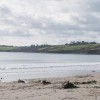
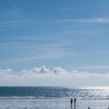
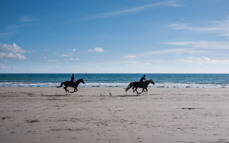
Pendower and Carne Beaches are adjacent to each other, situated within the same bay, predominantly used by tourists. The beaches are known for their low soft cliffs and rock pools, which have been designated Sites of Special Scientific Interest (SSSI's). At low tide, the two beaches join up to form a one and a half mile stretch of sand, with excellent views over Gerrans Bay.
The beaches offer a range of activities, including swimming, windsurfing, sailing, and kayaking. The gently sloping sand and soft waves make Carne an ideal spot for families, with children able to safely paddle in the shallows or explore the fascinating rock pools teeming with marine life. Nature enthusiasts can enjoy the diverse birdlife and marine creatures in the rock pools.
The area around Carne Beach holds intriguing secrets, including remnants of World War II defenses and a restored Cold War nuclear bunker on Nare Head. The beach and surrounding area are part of the Roseland Heritage Coast, with the South West Coast Path offering breathtaking views of the Cornish coastline.
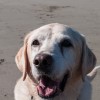
Facilities are limited to preserve the beach's natural charm, but the nearby Nare Hotel offers dining options for non-residents. The beach is easily accessible from a car park where the two beaches join up. Dog owners are welcome to bring their pets year-round, with some restrictions in place during summer.
Carne Beach has been named one of the world's top 10 beaches by National Geographic magazine.
Pendower Carne Beach is on The Roseland Heritage Coast, and adjacent to the South West Coast Path.
Sand
| Today |  |
|---|---|
| Chance of rain | % |
| Max temperature | 17°C |
| feels like | 18°C |
| Wind 17mph |  |
| Max UV Index |  |
| Tonight |  |
|---|---|
| Chance of rain | 46% |
| Min temperature | 15°C |
| feels like | 14°C |
| Wind 15mph | |
The tide at Pendower Carne Beach is currently rising. High tide will be at approximately 7:58 AM, and the next low tide will be at approximately 2:36 PM.
 Today's air pollution levels are forecast to be Low
 Food available
 Toilets
 Slipway
Pay & display. National Trust members park for free at Carne and Pendower car parks.
Dogs must be on a lead during the summer. Please clear up and take all litter home.
Community beach cleans, first Monday of the month.
No lifeguard cover at this beach

Water quality not measured here
less than a mile west as the seagull flies, less than a mile by road.
around 2 miles southwest as the seagull flies, around 5 miles by road or 2 miles on foot using coastal paths.
around 2 miles southwest as the seagull flies, around 5 miles by road or 3 miles on foot using coastal paths.
around 2 miles east-northeast as the seagull flies, around 3 miles by road.
around 2 miles southwest as the seagull flies, around 6 miles by road or 3 miles on foot using coastal paths.
around 4 miles south-southwest as the seagull flies, around 7 miles by road or 5 miles on foot using coastal paths.
around 4 miles east-northeast as the seagull flies, around 7 miles by road or 4 miles on foot using coastal paths.
around 5 miles south-southwest as the seagull flies, around 8 miles by road or 6 miles on foot using coastal paths.
around 5 miles east-northeast as the seagull flies, around 8 miles by road or 5 miles on foot using coastal paths.
around 6 miles southwest as the seagull flies, around 9 miles by road or 7 miles on foot using coastal paths.
around 6 miles east-northeast as the seagull flies, around 10 miles by road or 7 miles on foot using coastal paths.
around 7 miles east-northeast as the seagull flies, around 12 miles by road or 9 miles on foot using coastal paths.
around 7 miles east-northeast as the seagull flies, around 11 miles by road or 8 miles on foot using coastal paths.
around 7 miles east-northeast as the seagull flies, around 11 miles by road or 8 miles on foot using coastal paths.
around 8 miles east-northeast as the seagull flies, around 12 miles by road or 9 miles on foot using coastal paths.
around 8 miles northeast as the seagull flies, around 13 miles by road or 10 miles on foot using coastal paths.
around 8 miles northeast as the seagull flies, around 13 miles by road or 10 miles on foot using coastal paths.
around 9 miles northeast as the seagull flies, around 13 miles by road.
around 11 miles northeast as the seagull flies, around 16 miles by road.
around 11 miles northeast as the seagull flies, around 15 miles by road.
Location: Carne
Location type: Village
Nearest village: Veryan
OS Grid: SW904381
Coordinates: 50°12'23"N 4°56'16"W
Mapcode: GBR ZN.N263
What 3 Words: drip.puppy.maddening
Coordinates and location codes are for an approximate mid-point of the beach, and may not reflect the best access point or the most popular part of the beach.
Country: England
Local Authority: Cornwall
Parish: Veryan
Nearest postcode: TR2 5PF
(for sat-nav purposes only, a beach does not have a postal address!)
Important! Beach information is compiled from a variety of different sources and is correct to the best of our knowledge at the time of compilation. However, information may be incorrectly supplied by our sources or go out of date after publication. BritishBeaches.uk makes no warranty as to the accuracy of any information on this page.