Approximate Location Map
Use two fingers to pan or zoom the map
Use two fingers to pan or zoom the map
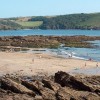
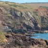
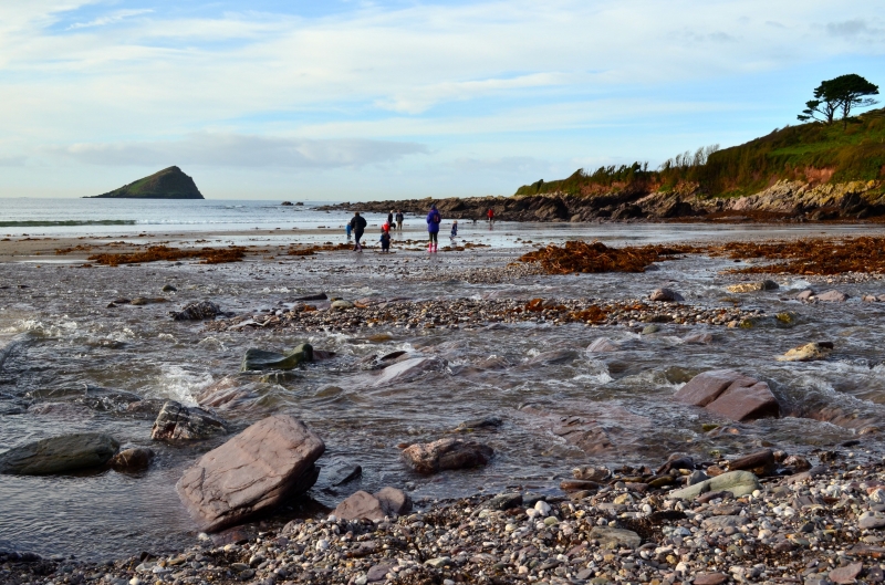
Wembury Beach is a sand and rock beach resort, approximately 1.1 kilometres wide, backed by cliffs. The beach is set in a cove and has lots to offer beachgoers, including a gently rolling Devon hills and pretty Wembury Church backdrop. The beach itself is mainly sand, although there are some areas of rocks and shingle. At low tide, a good-sized expanse of clean sand is revealed.
Wembury Beach is one of the best rockpooling destinations in the country, with explorers having a good chance of finding crabs, sea anemones, limpets, starfish, pipe fish, sea scorpions, and green sea-urchins among the rockpools. The best time to visit for rockpooling is just before low tide. The National Trust and Wembury Marine Centre organise rock pool rambles, providing an educational and fun experience for kids during the summer.
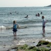
Apart from rockpooling, the beach is also a popular surf spot, attracting weekend crowds from nearby Plymouth. Snorkeling and diving are good here too, as there are some good reefs around the cove. Wembury Sailing Club has its base on the beach. The water quality is excellent, and the relatively shallow waters of the cove make it a popular place to paddle and play in the waves. However, children will need to be properly supervised as there is no lifeguard.
From the beach, there are views over the Mewstone, a rocky island with a distinctive triangular shape, which was used as a refuge for smugglers and even as a prison in the past. The island is now owned by the National Trust and used as a bird sanctuary, although visitors are not permitted. During the summer months, basking sharks are sometimes spotted in the waters around the rock. The South West Coastal Path leads to a ferry point, from which it is possible to cross over to Noss Mayo.
Wembury Beach is located down a quiet country lane and is set in an Area of Outstanding Natural Beauty on the South Devon coast. The beach is family-friendly, with a beachside kiosk and café for refreshments. Visitors can also visit the Wembury Marine Centre on the beachfront to learn about the marine and wildlife in the area. The surrounding countryside is great for walking the coastal path and nature trails.
Wembury Beach is on the South Devon Heritage Coast, and adjacent to the South West Coast Path.
Sand
| Today |  |
|---|---|
| Chance of rain | 100% |
| Max temperature | 17°C |
| feels like | 18°C |
| Wind 22mph |  |
| Max UV Index |  |
| Tonight |  |
|---|---|
| Chance of rain | 100% |
| Min temperature | 13°C |
| feels like | 11°C |
| Wind 27mph | |
The tide at Wembury Beach is currently falling. Low tide will be at approximately 12:42 PM, and the next high tide will be at approximately 6:51 PM.
Detailed weather and tides » Food available
 Toilets
There are approximately 150 car spaces available for a charge.
Dogs not allowed May to the end of September when a seasonal ban is in place.
Beach cleaned daily during the summer.
No lifeguard cover at this beach

Water quality not measured here
around 2 miles northwest as the seagull flies, around 3 miles by road.
around 3 miles east-southeast as the seagull flies, around 11 miles by road or 5 miles on foot using coastal paths.
around 4 miles northwest as the seagull flies, around 8 miles by road or 5 miles on foot using coastal paths.
around 4 miles northwest as the seagull flies, around 8 miles by road or 6 miles on foot using coastal paths.
around 5 miles west as the seagull flies, around 17 miles by road or 9 miles on foot using coastal paths.
around 5 miles west-northwest as the seagull flies, around 17 miles by road or 9 miles on foot using coastal paths.
around 6 miles east as the seagull flies, around 12 miles by road or 7 miles on foot using coastal paths.
around 6 miles east as the seagull flies, around 12 miles by road or 7 miles on foot using coastal paths.
around 6 miles east as the seagull flies, around 12 miles by road or 8 miles on foot using coastal paths.
around 7 miles west-northwest as the seagull flies, around 17 miles by road or 11 miles on foot using coastal paths.
around 8 miles west-northwest as the seagull flies, around 16 miles by road or 12 miles on foot using coastal paths.
around 8 miles east-southeast as the seagull flies, around 16 miles by road or 12 miles on foot using coastal paths.
around 9 miles east-southeast as the seagull flies, around 18 miles by road or 13 miles on foot using coastal paths.
around 9 miles east-southeast as the seagull flies, around 18 miles by road or 12 miles on foot using coastal paths.
around 9 miles west-northwest as the seagull flies, around 15 miles by road.
around 9 miles east-southeast as the seagull flies, around 18 miles by road or 12 miles on foot using coastal paths.
around 9 miles west-northwest as the seagull flies, around 15 miles by road.
around 9 miles east-southeast as the seagull flies, around 18 miles by road or 12 miles on foot using coastal paths.
around 9 miles east-southeast as the seagull flies, around 20 miles by road or 13 miles on foot using coastal paths.
around 10 miles east-southeast as the seagull flies, around 21 miles by road or 14 miles on foot using coastal paths.
Location: Knighton
Location type: Town
OS Grid: SX517483
Coordinates: 50°19'0"N 4°5'0"W
Mapcode: GBR NZ.YDYT
What 3 Words: drooling.surfed.author
Coordinates and location codes are for an approximate mid-point of the beach, and may not reflect the best access point or the most popular part of the beach.
County: Devon
Country: England
Local Authority: South Hams
Parish: Wembury
Nearest postcode: PL9 0HS
(for sat-nav purposes only, a beach does not have a postal address!)
Important! Beach information is compiled from a variety of different sources and is correct to the best of our knowledge at the time of compilation. However, information may be incorrectly supplied by our sources or go out of date after publication. BritishBeaches.uk makes no warranty as to the accuracy of any information on this page.