Approximate Location Map
Use two fingers to pan or zoom the map
Use two fingers to pan or zoom the map
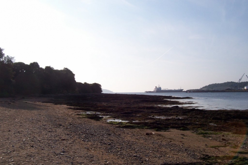
The beach can be accessed via a passenger ferry to Flushing, followed by a short walk. It is a small rocky beach that disappears at high tide and has some sand at low tide.
The beach is sheltered and rocky, making it a popular spot for snorkelling and diving, especially around the wartime wrecks offshore. Local dive centre, Dive UK, offers opportunities for both beginners and experienced divers to explore the underwater environment.
Visitors can walk along the Point to Pendennis Castle, the imposing coastal fortresses built by Henry VIII, for the best views across Falmouth Bay.
While there are no lifeguards on the beach, it is considered safe for swimming, especially among local groups. However, it is recommended to check the tide times and conditions before heading in. The beach tends to get busy during the summer months, attracting locals and visitors looking to enjoy the sun, sea, and sand.
Sand Rock
| Tonight |  |
|---|---|
| Chance of rain | 39% |
| Min temperature | 12°C |
| feels like | 11°C |
| Wind 18mph |  |
| Tomorrow |
 |
|---|---|
| Chance of rain | 40% |
| Max temperature | 15°C |
| feels like | 12°C |
| Wind 15mph |  |
| Max UV Index |  |
The tide at Flushing Trefusis Beach is currently rising. High tide will be at approximately 4:26 AM tomorrow, and the next low tide will be at approximately 10:58 AM tomorrow.
 Today's air pollution levels are forecast to be Low
 Slipway
There is limited roadside parking on Trefusis Road.
Dogs are allowed.
No lifeguard cover at this beach

Water quality not measured here
around 12 miles northwest as the seagull flies, around 16 miles by road.
around 12 miles northwest as the seagull flies, around 17 miles by road.
around 12 miles west-northwest as the seagull flies, around 16 miles by road.
around 13 miles north-northwest as the seagull flies, around 16 miles by road.
around 14 miles north-northwest as the seagull flies, around 18 miles by road.
around 15 miles north-northwest as the seagull flies, around 20 miles by road.
around 15 miles west-northwest as the seagull flies, around 20 miles by road.
around 16 miles west-northwest as the seagull flies, around 21 miles by road.
around 16 miles west-northwest as the seagull flies, around 21 miles by road.
around 16 miles west-northwest as the seagull flies, around 21 miles by road.
around 16 miles west as the seagull flies, around 21 miles by road.
around 16 miles west as the seagull flies, around 21 miles by road.
around 16 miles north-northwest as the seagull flies, around 23 miles by road.
around 17 miles north-northwest as the seagull flies, around 24 miles by road.
around 17 miles west as the seagull flies, around 25 miles by road.
around 17 miles west-southwest as the seagull flies, around 22 miles by road.
around 18 miles west as the seagull flies, around 25 miles by road.
around 19 miles west as the seagull flies, around 23 miles by road.
around 19 miles west as the seagull flies, around 29 miles by road.
around 19 miles west as the seagull flies, around 23 miles by road.
Location: Flushing
Location type: Town
OS Grid: SW814336
Coordinates: 50°9'43"N 5°3'42"W
Mapcode: GBR ZD.SZGX
What 3 Words: buck.bike.formal
Coordinates and location codes are for an approximate mid-point of the beach, and may not reflect the best access point or the most popular part of the beach.
Country: England
Local Authority: Cornwall
Parish: Mylor
Nearest postcode: TR11 5UB
(for sat-nav purposes only, a beach does not have a postal address!)
Important! Beach information is compiled from a variety of different sources and is correct to the best of our knowledge at the time of compilation. However, information may be incorrectly supplied by our sources or go out of date after publication. BritishBeaches.uk makes no warranty as to the accuracy of any information on this page.