Approximate Location Map
Use two fingers to pan or zoom the map
Use two fingers to pan or zoom the map
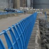
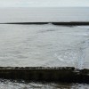
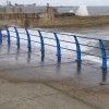
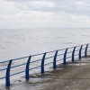
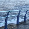
Grangetown Beach is a narrow strip of sand and shingle situated just to the south of the centre of Sunderland and the docks. The beach is backed by a promenade, suitable for cycling or jogging, some grassland, and a railway line. From Grangetown, there are views over the chimneys and industrial buildings of the docks. The England Coast Path, which was expected to be completed in 2020, passes through this area. The beach and promenade are popular with dog walkers. However, the area around the beach has been used for fly-tipping in the past, although measures are underway to prevent this problem from affecting the beach.
Ryhope Beach, located just north of Seaham, marks the border of Sunderland and Durham. This beach was once a popular seaside destination but has decreased in size due to coastal erosion. A small path leads to the beach, which is great for exploring rockpools at low tide or simply taking in the views. Ryhope Beach is also a popular sea angling destination and has no dog restrictions.
Sand Shingle
| Today | |
|---|---|
| Chance of rain | 86% |
| Max temperature | 16°C |
| feels like | 16°C |
| Wind 19mph | |
| Max UV Index |
| Tonight | |
|---|---|
| Chance of rain | 15% |
| Min temperature | 11°C |
| feels like | 11°C |
| Wind 17mph |
The tide at Grangetown Beach is currently high. Low tide will be at approximately 12:45 PM, and the next high tide will be at approximately 6:57 PM.
![]() Today's air pollution levels are forecast to be Low
Today's air pollution levels are forecast to be Low
There is parking next to the beach.
No lifeguard cover at this beach
Water quality not measured here
Marcus Barn 3

From £2230.00 per week at Sykes Holiday Cottages
Twitcher's Rest

From £1386.00 per week at Sykes Holiday Cottages
Tynemouth Village Penthouse

From £2470.00 per week at Sykes Holiday Cottages
Arbour House Farm Bungalow

From £3291.00 per week at Sykes Holiday Cottages
Premium 2 Bedroom Cottage Number 7

From £1734.00 per week at Sykes Holiday Cottages
16 Seafield Terrace

From £2276.00 per week at Sykes Holiday Cottages
Clue HQ Sunderland (1.2 miles)
Laser Quest Sunderland (1.3 miles)
National Glass Centre (1.6 miles)
The Ship Isis (1.7 miles)
Stadium Of Light (2 miles)
Roker & Seaburn Beaches (2.1 miles)
Rosebud Ceramics (2.7 miles)
The Serenity Spa (3 miles)
Herrington Country Park (3.2 miles)
All distances are approximate
less than a mile south as the seagull flies, less than a mile by road.
around 2 miles south-southeast as the seagull flies, around 2 miles by road or 2 miles on foot using coastal paths.
around 2 miles south-southeast as the seagull flies, around 2 miles by road or 2 miles on foot using coastal paths.
around 2 miles north as the seagull flies, around 3 miles by road.
around 3 miles south-southeast as the seagull flies, around 4 miles by road.
around 3 miles north as the seagull flies, around 4 miles by road.
around 4 miles south-southeast as the seagull flies, around 5 miles by road.
around 4 miles south-southeast as the seagull flies, around 5 miles by road.
around 4 miles south-southeast as the seagull flies, around 5 miles by road.
around 6 miles north as the seagull flies, around 7 miles by road.
around 7 miles south-southeast as the seagull flies, around 12 miles by road or 9 miles on foot using coastal paths.
around 8 miles north-northwest as the seagull flies, around 9 miles by road.
around 8 miles south-southeast as the seagull flies, around 11 miles by road.
around 10 miles south-southeast as the seagull flies, around 14 miles by road.
around 11 miles south-southeast as the seagull flies, around 16 miles by road.
around 12 miles south-southeast as the seagull flies, around 18 miles by road.
around 13 miles south-southeast as the seagull flies, around 20 miles by road.
around 14 miles south-southeast as the seagull flies, around 21 miles by road.
around 16 miles south-southeast as the seagull flies, around 22 miles by road.
around 18 miles south-southeast as the seagull flies, around 26 miles by road.
Location: Hendon, Sunderland
Location type: Urban
OS Grid: NZ411553
Coordinates: 54°53'27"N 1°21'35"W
Mapcode: GBR VH0.TN
What 3 Words: ruins.closet.tones
Coordinates and location codes are for an approximate mid-point of the beach, and may not reflect the best access point or the most popular part of the beach.
Country: England
Local Authority: Sunderland
Nearest postcode: SR2 8PT
(for sat-nav purposes only, a beach does not have a postal address!)
Important! Beach information is compiled from a variety of different sources and is correct to the best of our knowledge at the time of compilation. However, information may be incorrectly supplied by our sources or go out of date after publication. BritishBeaches.uk makes no warranty as to the accuracy of any information on this page.
(Or après-beach. Or pre-beach. Or, just because you might want stuff)
Men's Tops
Weird Fish Waves Front Print Graphic T-Shirt Rust Leaves Size M

Only £28.00 from Weird Fish