Approximate Location Map
Use two fingers to pan or zoom the map
Use two fingers to pan or zoom the map
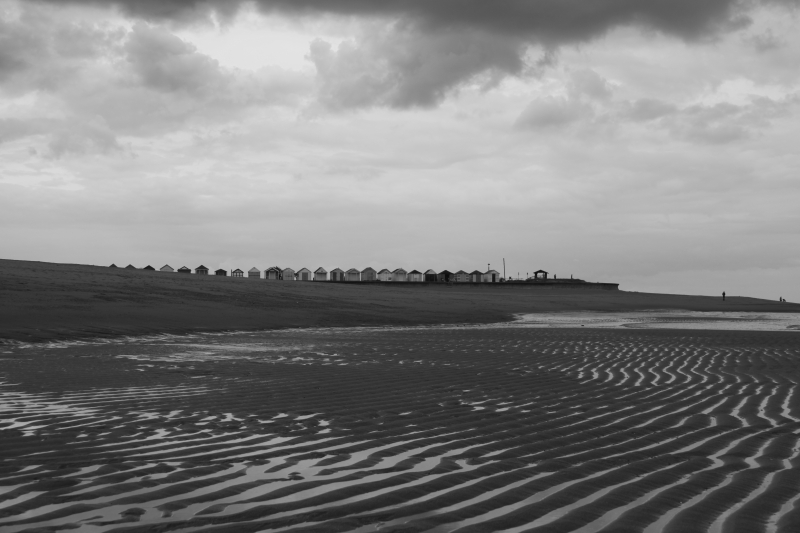
Chapel St Leonards Beach is a sand and shingle beach situated just along the coast from Ingoldmells and Skegness. The beach is backed by a promenade and the village, and offers a range of seaside and family facilities, including crazy golf, children's play areas, cafes, restaurants, amusement arcades, and a bookshop.
The beach is located on the Lincolnshire coastline, next to the resort town of Chapel St Leonards. It is a popular place for swimming and for family days out, and is also a good place for walking as the beaches stretch for many miles in both directions along this part of the Lincolnshire coastline. To the south, the beach leads to the larger resort town of Skegness, which is about 6 miles away.
The promenade alongside the beach boasts a pub, as well as plenty of other facilities such as toilets, pubs, restaurants, shops, and places to stay in the town of Chapel St Leonards. The town also features various caravan parks and resort-style attractions, including crazy golf, amusement arcades, and children's play areas.
There are a number of small car parks in the town of Chapel St Leonards, each one a short walk from the beach. The largest is the Well Vale Car Park, located along Well Vale Drive, about 150 meters from the beach. The beach is accessed down a short flight of steps.
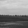
One mile north of the main beach entrance is Chapel Point, a defensive structure built during the Second World War. It is a popular viewing point, particularly for bird watchers. A little further north, there is a quieter section of beach towards Anderby Creek and Sandilands.
Sand Shingle
| Tonight | |
|---|---|
| Chance of rain | 67% |
| Min temperature | 11°C |
| feels like | 10°C |
| Wind 17mph |
| Tomorrow |
|
|---|---|
| Chance of rain | % |
| Max temperature | 17°C |
| feels like | 17°C |
| Wind 14mph | |
| Max UV Index |
The tide at Chapel St Leonards Beach is currently high. Low tide will be at approximately 3:56 AM tomorrow, and the next high tide will be at approximately 9:40 AM tomorrow.
![]() Today's air pollution levels are forecast to be Low
Today's air pollution levels are forecast to be Low
Car parking off St Leonards Drive, near the beach.
Dogs not allowed on certain areas.
Beach cleaned as required.
No information available
![]()
Excellent water quality
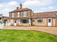
Westerby Lodge

From £1318.00 per week at Sykes Holiday Cottages
Norfolk Cottage
From £1648.00 per week at Holidaycottages.co.uk
Heron Lodge

From £1907.00 per week at Sykes Holiday Cottages
Sandy Toes

From £2875.00 per week at Sykes Holiday Cottages
Lake View Cottage

From £2130.00 per week at Sykes Holiday Cottages
Lincolnshire Cottage

From £823.00 per week at Holidaycottages.co.uk
The Admiral Benbow (0.1 miles)
Northcote Heavy Horse Centre (0.1 miles)
Hardys Animal Farm (1.7 miles)
Tiny Tots Village Indoor Playzone (2.2 miles)
Fantasy Island (2.2 miles)
Anderby Creek (2.5 miles)
On Your Marques (3.3 miles)
Skegness Stadium (3.5 miles)
Radcliffe Donkey Sanctuary (4.1 miles)
Orchard Farm Equestrian (6 miles)
All distances are approximate
around 2 miles south-southeast as the seagull flies, around 4 miles by road or 2 miles on foot using coastal paths.
around 3 miles north-northwest as the seagull flies, around 3 miles by road.
around 3 miles north-northwest as the seagull flies, around 4 miles by road.
around 6 miles south as the seagull flies, around 7 miles by road.
around 7 miles north-northwest as the seagull flies, around 10 miles by road or 7 miles on foot using coastal paths.
around 9 miles north-northwest as the seagull flies, around 12 miles by road or 10 miles on foot using coastal paths.
around 26 miles north-northwest as the seagull flies, around 38 miles by road.
around 27 miles north-northwest as the seagull flies, around 38 miles by road.
around 20 miles south-southeast as the seagull flies, around 80 miles by road.
around 21 miles south-southeast as the seagull flies, around 79 miles by road.
around 21 miles south-southeast as the seagull flies, around 79 miles by road.
around 22 miles south-southeast as the seagull flies, around 77 miles by road.
around 23 miles south-southeast as the seagull flies, around 77 miles by road.
around 25 miles south as the seagull flies, around 76 miles by road.
around 26 miles southeast as the seagull flies, around 89 miles by road.
around 27 miles southeast as the seagull flies, around 92 miles by road.
Location: Authorpe Row
Location type: Urban
Nearest village: Hogsthorpe
OS Grid: TF563722
Coordinates: 53°13'27"N 0°20'26"E
Mapcode: GBR MXV.WGP
What 3 Words: vibrating.inversely.require
Coordinates and location codes are for an approximate mid-point of the beach, and may not reflect the best access point or the most popular part of the beach.
County: Lincolnshire
Country: England
Local Authority: East Lindsey
Parish: Chapel St. Leonards
Nearest postcode: PE24 5TB
(for sat-nav purposes only, a beach does not have a postal address!)
Important! Beach information is compiled from a variety of different sources and is correct to the best of our knowledge at the time of compilation. However, information may be incorrectly supplied by our sources or go out of date after publication. BritishBeaches.uk makes no warranty as to the accuracy of any information on this page.
(Or après-beach. Or pre-beach. Or, just because you might want stuff)
Men's Trousers
Weird Fish Charleigh Textured Chino Trousers Stone Size 38

Only £33.00 from Weird Fish