Approximate Location Map
Use two fingers to pan or zoom the map
Use two fingers to pan or zoom the map
Pendine Morfa Bay comprises two beaches: Pendine Sands and Morfa Bychan Beach. Pendine Sands is a popular resort beach with fine sand and safe bathing, offering views over Carmarthen Bay to Tenby and Gower. The beach is surrounded by limestone cliffs, caves, and rock pools to the west, with facilities locally available at Pendine Village.
Pendine Sands is a sand and shingle beach situated at the bottom of a cliff top, overlooking Carmarthen Bay and surrounded by pleasant, hilly countryside. The beach is popular for walking and boating, with excellent views from the cliff tops and the chance of spotting marine wildlife such as seals, dolphins, or even whales out in the surf. While there are limited facilities at Pendine Village, the nearest town of any size is Saundersfoot, a few miles to the west, which offers a range of amenities, including shops, places to stay, and a railway station.
Morfa Bychan Beach, located near Pendine, is a slightly off-the-beaten-path beach backed by a rural landscape. This beach is ideal for scenic walks and features a lovely, sandy, unspoilt shoreline. Ragwen Point, a significant coastal landmark, is known for its scenic views and historical importance, having been the site of military exercises during World War II. A replica of the Atlantic Wall was constructed there for training related to the D-Day landings. Visitors can access Ragwen Point by walking along the cliff top path from Pendine Sands or following the track through the woods from Pendine Hill. This secluded beach is dog-friendly all year round, offering a wide open space to escape the crowds.
Pendine Morfa Bay is adjacent to the Wales Coast Path.
Bay Sand
| Today | |
|---|---|
| Chance of rain | 100% |
| Max temperature | 15°C |
| feels like | 15°C |
| Wind 24mph | |
| Max UV Index |
| Tonight | |
|---|---|
| Chance of rain | 24% |
| Min temperature | 9°C |
| feels like | 10°C |
| Wind 23mph |
The tide at Pendine Morfa Bay is currently rising. High tide will be at approximately 9:06 AM, and the next low tide will be at approximately 3:10 PM.
![]() Today's air pollution levels are forecast to be Low
Today's air pollution levels are forecast to be Low
There is is parking near the beach.
Dogs not allowed between the slipways - May to September.
No lifeguard cover at this beach
Water quality not measured here
Coastal Dyfed House
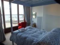
From £626.00 per week at Holidaycottages.co.uk
Cambriol

From £2274.00 per week at Sykes Holiday Cottages
Dyfed Cottage
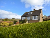
From £720.00 per week at Holidaycottages.co.uk
Awel Deg, Newport

From £3405.00 per week at Sykes Holiday Cottages
Coastal Dyfed Apartment

From £501.00 per week at Holidaycottages.co.uk
Potters Barn

From £2598.00 per week at Sykes Holiday Cottages
Pendine Sands (0.8 miles)
Morfa Bay Adventure (0.9 miles)
Marros Riding Centre (1.3 miles)
Colby Woodland Garden (National Trust) (4.2 miles)
Wisemans Bridge (4.9 miles)
Laugharne Castle (5.2 miles)
The Original Tin Shed Experience (5.3 miles)
St. Martin's Church (5.4 miles)
Dylan Thomas Boathouse (5.5 miles)
All distances are approximate
less than a mile east as the seagull flies, around 3 miles by road.
around 4 miles west as the seagull flies, around 4 miles by road.
around 5 miles west-southwest as the seagull flies, around 6 miles by road.
around 5 miles east-northeast as the seagull flies, around 8 miles by road.
around 5 miles west-southwest as the seagull flies, around 7 miles by road.
around 6 miles west-southwest as the seagull flies, around 10 miles by road.
around 6 miles west-southwest as the seagull flies, around 8 miles by road.
around 6 miles west-southwest as the seagull flies, around 8 miles by road.
around 6 miles southwest as the seagull flies, around 10 miles by road.
around 7 miles southwest as the seagull flies, around 11 miles by road.
around 7 miles southwest as the seagull flies, around 11 miles by road.
around 8 miles southwest as the seagull flies, around 12 miles by road.
around 8 miles east-northeast as the seagull flies, around 23 miles by road or 13 miles on foot using coastal paths.
around 8 miles southwest as the seagull flies, around 13 miles by road.
around 8 miles southwest as the seagull flies, around 13 miles by road.
around 8 miles east as the seagull flies, around 32 miles by road.
around 10 miles southwest as the seagull flies, around 14 miles by road.
around 11 miles southwest as the seagull flies, around 16 miles by road.
around 11 miles east-southeast as the seagull flies, around 37 miles by road.
around 12 miles southwest as the seagull flies, around 16 miles by road.
Location: Pentywyn (Pendine)
Location type: Village
OS Grid: SN224074
Coordinates: 51°44'16"N 4°34'20"W
Mapcode: GBR GJ.0MZ3
What 3 Words: drawn.copes.finally
Coordinates and location codes are for an approximate mid-point of the beach, and may not reflect the best access point or the most popular part of the beach.
Country: Wales
Local Authority: Carmarthenshire
Parish: Eglwyscummin
Nearest postcode: SA33 4PB
(for sat-nav purposes only, a beach does not have a postal address!)
Important! Beach information is compiled from a variety of different sources and is correct to the best of our knowledge at the time of compilation. However, information may be incorrectly supplied by our sources or go out of date after publication. BritishBeaches.uk makes no warranty as to the accuracy of any information on this page.
(Or après-beach. Or pre-beach. Or, just because you might want stuff)
Men's Tops
Weird Fish Miles Pique Polo Shirt Aqua Marine Size 4XL

Only £38.00 from Weird Fish