Approximate Location Map
Use two fingers to pan or zoom the map
Use two fingers to pan or zoom the map
Porthglaze Cove is situated between the villages of Pendeen and Morvah, and lies on the South West Coast Path between Zennor Head and Gurnard's Head.
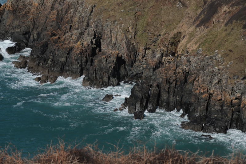
The cove is surrounded by rugged cliffs and offers stunning views of the Atlantic Ocean. It is renowned for its unspoilt beauty and tranquil environment, making it ideal for those seeking a peaceful retreat away from the crowds.
Despite its natural charm, the beach lacks facilities and has no lifeguard service. Visitors should exercise caution when swimming, as the beach can experience strong rip currents, particularly at low tide.
The beach is a favorite among nature lovers, with the opportunity to see seals. It is also dog-friendly year-round, which adds to its appeal for pet owners. The spectacular seascape views make it perfect for coastal walkers.
Porthglaze Cove is on the Penwith Heritage Coast, and adjacent to the South West Coast Path.
Sand
| Tonight |  |
|---|---|
| Chance of rain | 92% |
| Min temperature | 12°C |
| feels like | 11°C |
| Wind 32mph |  |
| Tomorrow |
 |
|---|---|
| Chance of rain | 52% |
| Max temperature | 13°C |
| feels like | 16°C |
| Wind 23mph |  |
| Max UV Index |  |
The tide at Porthglaze Cove is currently falling. Low tide will be at approximately 12:23 AM tomorrow, and the next high tide will be at approximately 6:13 AM tomorrow.
Detailed weather and tides »Park at Zennor and leave some time for walking to join the Coastal path and cove.
No lifeguard cover at this beach

Water quality not measured here
less than a mile northeast as the seagull flies, just over a mile by road.
just over a mile southwest as the seagull flies, just over a mile by road.
around 4 miles west-southwest as the seagull flies, around 5 miles by road.
around 5 miles east-northeast as the seagull flies, around 6 miles by road.
around 5 miles east-northeast as the seagull flies, around 6 miles by road.
around 5 miles east-northeast as the seagull flies, around 6 miles by road.
around 5 miles south-southeast as the seagull flies, around 6 miles by road.
around 5 miles east as the seagull flies, around 8 miles by road.
around 5 miles south-southeast as the seagull flies, around 6 miles by road.
around 6 miles south-southeast as the seagull flies, around 7 miles by road.
around 6 miles south-southeast as the seagull flies, around 11 miles by road or 8 miles on foot using coastal paths.
around 6 miles east as the seagull flies, around 8 miles by road.
around 6 miles southeast as the seagull flies, around 9 miles by road.
around 7 miles southwest as the seagull flies, around 11 miles by road.
around 7 miles southeast as the seagull flies, around 9 miles by road.
around 7 miles southwest as the seagull flies, around 11 miles by road.
around 7 miles southwest as the seagull flies, around 11 miles by road.
around 7 miles east as the seagull flies, around 14 miles by road.
around 7 miles east as the seagull flies, around 14 miles by road.
around 8 miles south-southeast as the seagull flies, around 13 miles by road or 10 miles on foot using coastal paths.
Location: Boswednack
Location type: Rural
Nearest village: Nancledra
OS Grid: SW442385
Coordinates: 50°11'28"N 5°35'5"W
Mapcode: GBR DXL5.NLT
What 3 Words: whizzing.doses.jobs
Coordinates and location codes are for an approximate mid-point of the beach, and may not reflect the best access point or the most popular part of the beach.
Country: England
Local Authority: Cornwall
Parish: Zennor
Nearest postcode: TR26 3DD
(for sat-nav purposes only, a beach does not have a postal address!)
Important! Beach information is compiled from a variety of different sources and is correct to the best of our knowledge at the time of compilation. However, information may be incorrectly supplied by our sources or go out of date after publication. BritishBeaches.uk makes no warranty as to the accuracy of any information on this page.