Approximate Location Map
Use two fingers to pan or zoom the map
Use two fingers to pan or zoom the map
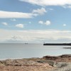
Mounts Bay is located on the south coast of Cornwall and features four designated bathing waters: Wherry Town, Penzance, Heliport, and Marazion. The beaches in the area are sandy resorts backed by sea defences, with Heliport beach being approximately one kilometre wide. The Ponsandane Brook flows onto the western end of Heliport beach.
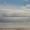
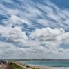
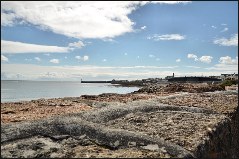
There are several beaches in the Mounts Bay area, each with its own unique characteristics. Eastern Green Beach is the closest beach to Penzance and is accessed via a concrete footpath from the bus station. The sheltered sand and shingle beach follows the curve of Mount’s Bay to Long Rock, offering clean water and safe swimming, making it popular with locals. Long Rock Beach itself is formed by an expanse of hard sand backed by coastal protection walls of granite. The beach is popular with walkers and looks out to St Michael's Mount, with a cycle path running along the back of the beach.
Eastern Green Beach is part of a long stretch of sand from west Chy-an-Dour in Penzance to Marazion, on the Cornwall coast. The beach offers panoramic views and ample opportunities for beachcombing and sunbathing, making it the perfect spot for a day of coastal exploration.
It is worth noting that the description of Long Rock Beach is repeated, however the key points remain that the beach has an expanse of hard sand backed by coastal protection walls of granite, is popular with walkers, and looks out to St Michael's Mount with a cycle path along the back.
Long Rock Beach is adjacent to the South West Coast Path.
Sand
| Today | |
|---|---|
| Chance of rain | 94% |
| Max temperature | 14°C |
| feels like | 14°C |
| Wind 28mph | |
| Max UV Index |
| Tonight | |
|---|---|
| Chance of rain | 39% |
| Min temperature | 11°C |
| feels like | 11°C |
| Wind 27mph |
The tide at Long Rock Beach is currently rising. High tide will be at approximately 7:44 AM, and the next low tide will be at approximately 2:18 PM.
![]() Today's air pollution levels are forecast to be Low
Today's air pollution levels are forecast to be Low
There are three large car parks nearby for 600 cars with disabled spaces.
Dogs are allowed but must be kept under control.
Beach cleaned regularly.
No information available
![]()
Excellent water quality
Longships

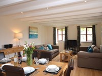
From £336.00 per week at Rural Retreats
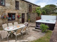
Penwarne Lodge

From £3497.00 per week at Sykes Holiday Cottages
The Crows Nest

From £3280.00 per week at Sykes Holiday Cottages
Romantic Rural Cornwall Cottage
From £574.00 per week at Holidaycottages.co.uk
Luxury Cornwall Farm Cottage
From £1173.00 per week at Holidaycottages.co.uk
Rocky Close

From £9672.00 per week at Sykes Holiday Cottages
Marine Discovery (0.7 miles)
Mermaid Pleasure Trips (0.8 miles)
Eureka Escape Cornwall (0.9 miles)
Lands End Cycle Hire (1.2 miles)
Kernow Coasteering (1.4 miles)
Ocean High (1.8 miles)
Newlyn Filmhouse (1.9 miles)
St. Michael's Mount (1.9 miles)
Cornwalls Great Escape Rooms Ltd (2 miles)
Western Discoveries Day Tours (2.6 miles)
Thai Moon (270 yards)
All distances are approximate
less than a mile west-southwest as the seagull flies, less than a mile by road.
less than a mile southwest as the seagull flies, just over a mile by road.
around 2 miles southwest as the seagull flies, around 2 miles by road.
around 2 miles east as the seagull flies, around 3 miles by road or 2 miles on foot using coastal paths.
around 2 miles east as the seagull flies, around 3 miles by road or 2 miles on foot using coastal paths.
around 3 miles south-southwest as the seagull flies, around 6 miles by road or 4 miles on foot using coastal paths.
around 4 miles east-southeast as the seagull flies, around 5 miles by road or 4 miles on foot using coastal paths.
around 5 miles south-southwest as the seagull flies, around 6 miles by road.
around 5 miles north-northwest as the seagull flies, around 6 miles by road.
around 5 miles northwest as the seagull flies, around 6 miles by road.
around 6 miles north-northwest as the seagull flies, around 7 miles by road.
around 6 miles north-northeast as the seagull flies, around 8 miles by road.
around 6 miles north-northeast as the seagull flies, around 8 miles by road.
around 6 miles east-southeast as the seagull flies, around 8 miles by road.
around 6 miles north-northeast as the seagull flies, around 8 miles by road.
around 6 miles north-northeast as the seagull flies, around 8 miles by road.
around 7 miles east-southeast as the seagull flies, around 8 miles by road.
around 7 miles north-northeast as the seagull flies, around 8 miles by road.
around 7 miles west-northwest as the seagull flies, around 9 miles by road.
around 7 miles northeast as the seagull flies, around 10 miles by road.
Location: Chyandour,
Location type: Urban
OS Grid: SW485310
Coordinates: 50°7'33"N 5°31'9"W
Mapcode: GBR DXRB.W4S
What 3 Words: fell.segmented.outermost
Coordinates and location codes are for an approximate mid-point of the beach, and may not reflect the best access point or the most popular part of the beach.
Country: England
Local Authority: Cornwall
Parish: Penzance
Nearest postcode: TR18 3DP
(for sat-nav purposes only, a beach does not have a postal address!)
Important! Beach information is compiled from a variety of different sources and is correct to the best of our knowledge at the time of compilation. However, information may be incorrectly supplied by our sources or go out of date after publication. BritishBeaches.uk makes no warranty as to the accuracy of any information on this page.
(Or après-beach. Or pre-beach. Or, just because you might want stuff)
Women's Trousers
Weird Fish Farida Wide Leg Trouser Navy Size 12

Only £48.75 from Weird Fish