Approximate Location Map
Use two fingers to pan or zoom the map
Use two fingers to pan or zoom the map
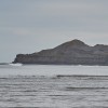
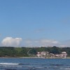
Runswick Bay Beach is a rural beach situated on the Yorkshire coast, measuring 700 metres in length. The beach is lined with shingles at the top and features clay boulders at the southern end of the bathing area. The beach slopes gently towards the sea, and at low tide, a large area of the beach is exposed.
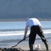
The bay is widely regarded as one of the prettiest spots on the Yorkshire coast, offering a range of activities for visitors. In the summer months, the beach is ideal for sandcastles, beach games, rock pooling, and swimming. Out of season, the area is popular for cliff-top walks along the Cleveland Way and fossil hunting. Visitors may also be lucky enough to spot seals at any time of year.
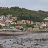
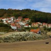
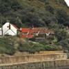
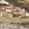
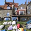
The former fishing village of Runswick, nestling under the cliffs at the top end of the beach, is picture-postcard pretty, with its whitewashed or natural honey-hued stone cottages topped with red roofs. The village is car-free, making it a great place for a stroll through the narrow, winding streets.
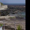
The beach itself is a mix of sand, with scattered rocks and stony areas, and is probably the best stretch of sand that can be found along this part of the coast. When the tide is out, the rocks which are exposed near the shoreline are frequently found to contain interesting fossils. The bay is popular with canoeists, surfers, and sea-anglers, particularly in the winter months.
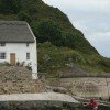
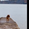
In recent years, access to the beach has been greatly improved with the widening of the previously steep, single-track road. There is a reasonable-sized car park towards the bottom of the hill, plus one further up. Runswick Bay beach is dog-friendly, with no restrictions at any time of year.
Runswick Bay is a protected area, designated as a Marine Conservation Zone due to its important and productive seabed habitat.
Runswick Bay is on the North Yorkshire & Cleveland Heritage Coast.
Bay Sand Mud
| Today |  |
|---|---|
| Chance of rain | 54% |
| Max temperature | 13°C |
| feels like | 12°C |
| Wind 14mph |  |
| Max UV Index |  |
| Tonight |  |
|---|---|
| Chance of rain | 53% |
| Min temperature | 9°C |
| feels like | 8°C |
| Wind 15mph |  |
The tide at Runswick Bay is currently falling. Low tide will be at approximately 1:51 PM, and the next high tide will be at approximately 8:02 PM.
 Today's air pollution levels are forecast to be Low
 Campsite
 Toilets
 Slipway
Parking is available a short walk from the beach.
Dogs are allowed
No lifeguard cover at this beach


Water quality not measured here
around 3 miles northwest as the seagull flies, around 3 miles by road.
around 4 miles east-southeast as the seagull flies, around 6 miles by road.
around 6 miles east-southeast as the seagull flies, around 9 miles by road.
around 7 miles west-northwest as the seagull flies, around 9 miles by road.
around 10 miles west-northwest as the seagull flies, around 11 miles by road.
around 11 miles southeast as the seagull flies, around 14 miles by road.
around 12 miles west-northwest as the seagull flies, around 15 miles by road.
around 13 miles west-northwest as the seagull flies, around 16 miles by road.
around 14 miles west-northwest as the seagull flies, around 16 miles by road.
around 14 miles west-northwest as the seagull flies, around 17 miles by road.
around 15 miles west-northwest as the seagull flies, around 21 miles by road.
around 19 miles west-northwest as the seagull flies, around 38 miles by road.
around 20 miles west-northwest as the seagull flies, around 38 miles by road.
around 20 miles west-northwest as the seagull flies, around 41 miles by road.
around 21 miles southeast as the seagull flies, around 27 miles by road.
around 22 miles west-northwest as the seagull flies, around 45 miles by road.
around 22 miles southeast as the seagull flies, around 28 miles by road.
around 23 miles southeast as the seagull flies, around 29 miles by road.
around 23 miles west-northwest as the seagull flies, around 44 miles by road.
around 24 miles northwest as the seagull flies, around 44 miles by road.
Location: Runswick Bay
Location type: Village
OS Grid: NZ811158
Coordinates: 54°31'52"N 0°44'51"W
Mapcode: GBR RJ61.YH
What 3 Words: locked.pinch.confident
Coordinates and location codes are for an approximate mid-point of the beach, and may not reflect the best access point or the most popular part of the beach.
County: North Yorkshire
Country: England
Local Authority: Scarborough
Parish: Ellerby
Nearest postcode: TS13 5HT
(for sat-nav purposes only, a beach does not have a postal address!)
Important! Beach information is compiled from a variety of different sources and is correct to the best of our knowledge at the time of compilation. However, information may be incorrectly supplied by our sources or go out of date after publication. BritishBeaches.uk makes no warranty as to the accuracy of any information on this page.