Approximate Location Map
Use two fingers to pan or zoom the map
Use two fingers to pan or zoom the map
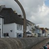
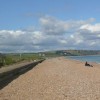
Slapton Sands Torcross Beach is situated near the small village of Torcross, where visitors can find a range of pubs, shops, and cottages. The beach itself is a long, single stretch of shingle and pebble that runs south to Beesands and north to the WWII Exercise Tiger Memorial. Despite its name, the beach is largely composed of shingle and pebble, but this does not detract from its undeniably pretty scenery.
The coastline at Slapton Sands has been designated as an "Area of Outstanding Natural Beauty" and is a haven for wildlife. The beach is backed by Slapton Ley Nature Reserve, a large freshwater lake that is home to many examples of rare flora and fauna.
The beach has a significant historical importance, having been used in 1943 as a rehearsal site for the D-Day Landings. Unfortunately, the exercise, known as "Operation Tiger", resulted in the deaths of several hundred American soldiers due to poor weather and live ammunition. A stone monument on the beach pays tribute to the soldiers who lost their lives.
Today, Slapton Sands is a popular family-friendly beach with calm waters and plenty of space. Visitors can enjoy a range of water sports, including surfing, windsurfing, and canoeing. Lifeguards operate on the beach during the summer season, providing a safe environment for swimming. Amenities include a beach cafe, toilets, and disabled access. The beach is also dog-friendly, allowing dogs to be present throughout the year.
Nearby Beesands Beach offers a similar experience, with a small village and a long shingle beach.
Slapton Sands Torcross Beach is on the South Devon Heritage Coast, and adjacent to the South West Coast Path.
Shingle
| Today |  |
|---|---|
| Chance of rain | 32% |
| Max temperature | 14°C |
| feels like | 12°C |
| Wind 25mph |  |
| Max UV Index |  |
| Tonight |  |
|---|---|
| Chance of rain | 92% |
| Min temperature | 12°C |
| feels like | 9°C |
| Wind 18mph |  |
The tide at Slapton Sands Torcross Beach is currently rising. High tide will be at approximately 6:15 PM, and the next low tide will be at approximately 12:26 AM tomorrow.
Detailed weather and tides » Food available
 Toilets
 Shops
Shops
Free parking is available near the beach.
Dogs are welcome.
No lifeguard cover at this beach


Water quality not measured here
just over a mile south as the seagull flies, around 3 miles by road or just over a mile on foot using coastal paths.
just over a mile north-northeast as the seagull flies, around 5 miles by road or 2 miles on foot using coastal paths.
around 2 miles south as the seagull flies, around 4 miles by road or 2 miles on foot using coastal paths.
around 2 miles north-northeast as the seagull flies, around 5 miles by road or 2 miles on foot using coastal paths.
around 3 miles south as the seagull flies, around 5 miles by road.
around 4 miles north-northeast as the seagull flies, around 8 miles by road or 4 miles on foot using coastal paths.
around 5 miles north-northeast as the seagull flies, around 9 miles by road or 5 miles on foot using coastal paths.
around 5 miles southwest as the seagull flies, around 7 miles by road.
around 5 miles southwest as the seagull flies, around 7 miles by road.
around 6 miles west-southwest as the seagull flies, around 8 miles by road.
around 6 miles northeast as the seagull flies, around 11 miles by road or 7 miles on foot using coastal paths.
around 9 miles west as the seagull flies, around 11 miles by road.
around 9 miles west as the seagull flies, around 12 miles by road.
around 9 miles west as the seagull flies, around 13 miles by road.
around 9 miles west as the seagull flies, around 13 miles by road.
around 10 miles west as the seagull flies, around 12 miles by road.
around 10 miles west as the seagull flies, around 12 miles by road.
around 13 miles west-northwest as the seagull flies, around 22 miles by road or 16 miles on foot using coastal paths.
around 13 miles west-northwest as the seagull flies, around 22 miles by road or 16 miles on foot using coastal paths.
around 14 miles west-northwest as the seagull flies, around 22 miles by road or 16 miles on foot using coastal paths.
Location: Torcross
Location type: Village
OS Grid: SX823421
Coordinates: 50°16'2"N 3°39'6"W
Mapcode: GBR QP.BPGS
What 3 Words: race.haggis.apartment
Coordinates and location codes are for an approximate mid-point of the beach, and may not reflect the best access point or the most popular part of the beach.
County: Devon
Country: England
Local Authority: South Hams
Parish: Stokenham
Nearest postcode: TQ7 2TQ
(for sat-nav purposes only, a beach does not have a postal address!)
Important! Beach information is compiled from a variety of different sources and is correct to the best of our knowledge at the time of compilation. However, information may be incorrectly supplied by our sources or go out of date after publication. BritishBeaches.uk makes no warranty as to the accuracy of any information on this page.