Approximate Location Map
Use two fingers to pan or zoom the map
Use two fingers to pan or zoom the map
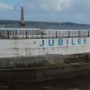
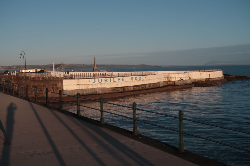
The foreshore of Penzance Promenade Beach is mostly rocks, only visible at low tide, with steps leading down into the water near the Jubilee Pool. There are a couple of areas that could be described as beaches between Penzance harbour and the end of the Promenade at Wherrytown. At lower tides, a small band of sand and shingle can be found running along the front of the Promenade.
For swimming, Battery Rocks, the headland behind the Jubilee Pool, is a popular spot. From here, there are sets of steps leading down to the water, expressly for swimming. This area of Mounts Bay is fairly sheltered and generally safe for swimming, although it is not lifeguarded. The rocky foreshore is great for rockpooling, but not ideal for paddling.
Tucked in between Battery Rocks and the old harbour wall is a little-known patch of sand. It is only really accessible at low tide, and there are very few visitors to this spot. Nevertheless, it is a pleasant enough spot for those looking for a quieter experience.
Wherrytown Beach, located between Newlyn and Penzance, is an ideal spot for families on a sunny day. The south west coast path runs along the beach front promenade, with easy access to parking and facilities. Visitors can enjoy watersports or the seafront park and attractions of the town. Dogs are restricted from Wherry Town to Battery Rocks between 1st July – 31st August, 10am – 6pm.
Also known as Marazion, the beaches in this area are formed by an expanse of hard sand backed by coastal protection walls of granite. The beach is popular with walkers and looks out to St Michael's Mount. A cycle path runs along the back of the beach.
Penzance Promenade Beach is adjacent to the South West Coast Path.
Sand Pebbles
| Tonight |  |
|---|---|
| Chance of rain | 91% |
| Min temperature | 13°C |
| feels like | 12°C |
| Wind 33mph |  |
| Tomorrow |
 |
|---|---|
| Chance of rain | 49% |
| Max temperature | 13°C |
| feels like | 16°C |
| Wind 24mph |  |
| Max UV Index |  |
The tide at Penzance Promenade Beach is currently falling. Low tide will be at approximately 12:13 AM tomorrow, and the next high tide will be at approximately 5:49 AM tomorrow.
Detailed weather and tides » Food available
 Toilets
There are three large car parks nearby for 600 cars with spaces for disabled people.
Dogs are allowed but must be kept under control.
Beach cleaned regularly.
No information available

Water quality not measured here
less than a mile southwest as the seagull flies, less than a mile by road.
less than a mile north-northeast as the seagull flies, less than a mile by road.
less than a mile northeast as the seagull flies, around 2 miles by road or just over a mile on foot using coastal paths.
around 2 miles south as the seagull flies, around 3 miles by road.
around 2 miles east-northeast as the seagull flies, around 4 miles by road.
around 3 miles east-northeast as the seagull flies, around 4 miles by road.
around 4 miles south-southwest as the seagull flies, around 5 miles by road.
around 4 miles east as the seagull flies, around 6 miles by road.
around 6 miles northwest as the seagull flies, around 11 miles by road or 7 miles on foot using coastal paths.
around 6 miles north-northwest as the seagull flies, around 7 miles by road.
around 6 miles north-northwest as the seagull flies, around 8 miles by road.
around 6 miles east as the seagull flies, around 8 miles by road.
around 6 miles west-northwest as the seagull flies, around 8 miles by road.
around 7 miles north-northeast as the seagull flies, around 9 miles by road.
around 7 miles northeast as the seagull flies, around 9 miles by road.
around 7 miles north-northeast as the seagull flies, around 9 miles by road.
around 7 miles east as the seagull flies, around 9 miles by road.
around 7 miles west-southwest as the seagull flies, around 8 miles by road.
around 7 miles southwest as the seagull flies, around 10 miles by road.
around 7 miles north-northeast as the seagull flies, around 9 miles by road.
Location: Penzance
Location type: Urban
OS Grid: SW474298
Coordinates: 50°6'53"N 5°31'59"W
Mapcode: GBR DXQC.VLG
What 3 Words: theory.breathy.replays
Coordinates and location codes are for an approximate mid-point of the beach, and may not reflect the best access point or the most popular part of the beach.
Country: England
Local Authority: Cornwall
Parish: Penzance
Nearest postcode: TR18 4BA
(for sat-nav purposes only, a beach does not have a postal address!)
Important! Beach information is compiled from a variety of different sources and is correct to the best of our knowledge at the time of compilation. However, information may be incorrectly supplied by our sources or go out of date after publication. BritishBeaches.uk makes no warranty as to the accuracy of any information on this page.