Approximate Location Map
Use two fingers to pan or zoom the map
Use two fingers to pan or zoom the map
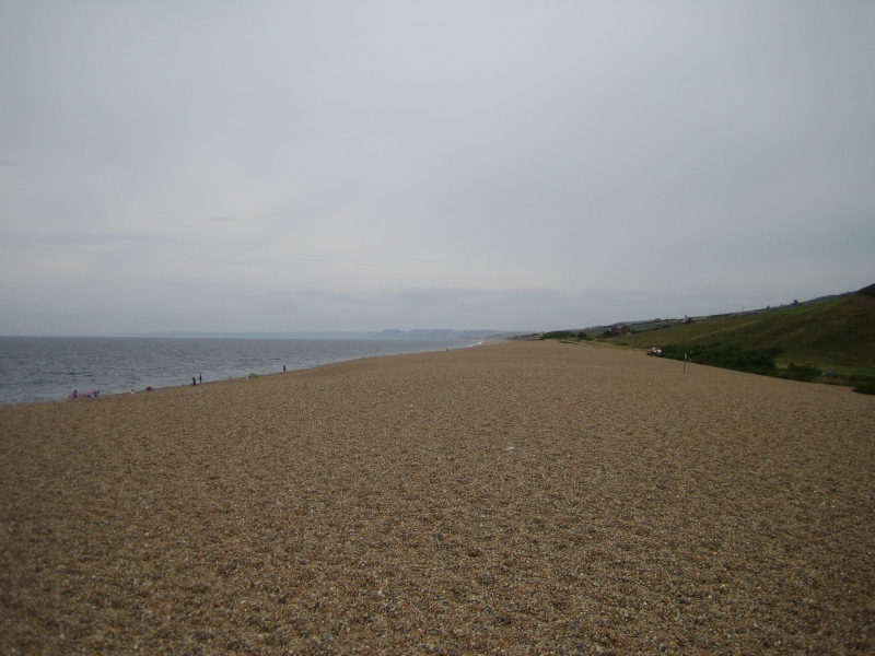
Chesil Beach stretches nearly 17 miles from Portland in the southeast to West Bay in the northwest. The beach is characterised by a huge bank of pebbles, with a consistent height of around 15m and width of 600m. The size of the pebbles varies along the beach, increasing from shingle-sized at West Bay to larger pebbles at Portland.
The southeastern section of Chesil Beach backs onto The Fleet Lagoon, a body of water that was utilised by Barnes Wallace for testing the bouncing bomb used by the Dambusters during World War II. The beach is almost straight, with a slight concave curve visible from the sea.
Chesil Beach is the longest beach in the UK, offering stunning views and opportunities for long walks. Most of the beach is separated from the mainland by the Fleet Lagoon, providing an uninterrupted coastal experience.
Chesil Beach is on the West Dorset Heritage Coast and the Jurassic Coast.
Pebble Shingle
| Tonight |  |
|---|---|
| Chance of rain | 100% |
| Min temperature | 15°C |
| feels like | 15°C |
| Wind 34mph |  |
| Tomorrow |
 |
|---|---|
| Chance of rain | 76% |
| Max temperature | 15°C |
| feels like | 17°C |
| Wind 25mph |  |
| Max UV Index |  |
The tide at Chesil Beach is currently falling. Low tide will be at approximately 11:59 PM, and the next high tide will be at approximately 6:43 AM tomorrow.
Detailed weather and tides »
The beach is regularly litter-picked by volunteers.
No lifeguard cover at this beach

Water quality not measured here
just over a mile northeast as the seagull flies, around 2 miles by road or just over a mile on foot using coastal paths.
just over a mile northeast as the seagull flies, around 2 miles by road or just over a mile on foot using coastal paths.
around 2 miles southeast as the seagull flies, around 3 miles by road.
around 4 miles north-northeast as the seagull flies, around 4 miles by road.
around 4 miles southeast as the seagull flies, around 5 miles by road.
around 4 miles northeast as the seagull flies, around 5 miles by road.
around 4 miles northeast as the seagull flies, around 6 miles by road.
around 7 miles east-northeast as the seagull flies, around 10 miles by road.
around 9 miles east-northeast as the seagull flies, around 18 miles by road or 13 miles on foot using coastal paths.
around 9 miles east-northeast as the seagull flies, around 17 miles by road or 13 miles on foot using coastal paths.
around 10 miles east-northeast as the seagull flies, around 17 miles by road or 13 miles on foot using coastal paths.
around 11 miles east-northeast as the seagull flies, around 18 miles by road.
around 13 miles northwest as the seagull flies, around 16 miles by road.
around 15 miles northwest as the seagull flies, around 18 miles by road.
around 15 miles northwest as the seagull flies, around 18 miles by road.
around 16 miles east as the seagull flies, around 27 miles by road.
around 16 miles northwest as the seagull flies, around 20 miles by road.
around 18 miles west-northwest as the seagull flies, around 22 miles by road.
around 21 miles west-northwest as the seagull flies, around 26 miles by road.
around 21 miles west-northwest as the seagull flies, around 26 miles by road.
Location: Wyke Regis, Weymouth
Location type: Urban
OS Grid: SY658762
Coordinates: 50°35'5"N 2°28'58"W
Mapcode: GBR PX.W1J1
What 3 Words: player.gent.winks
Coordinates and location codes are for an approximate mid-point of the beach, and may not reflect the best access point or the most popular part of the beach.
County: Dorset
Country: England
Local Authority: Weymouth and Portland
Parish: Portland
Nearest postcode: DT4 9YU
(for sat-nav purposes only, a beach does not have a postal address!)
Important! Beach information is compiled from a variety of different sources and is correct to the best of our knowledge at the time of compilation. However, information may be incorrectly supplied by our sources or go out of date after publication. BritishBeaches.uk makes no warranty as to the accuracy of any information on this page.