Approximate Location Map
Use two fingers to pan or zoom the map
Use two fingers to pan or zoom the map
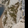
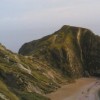
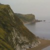
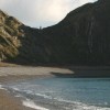
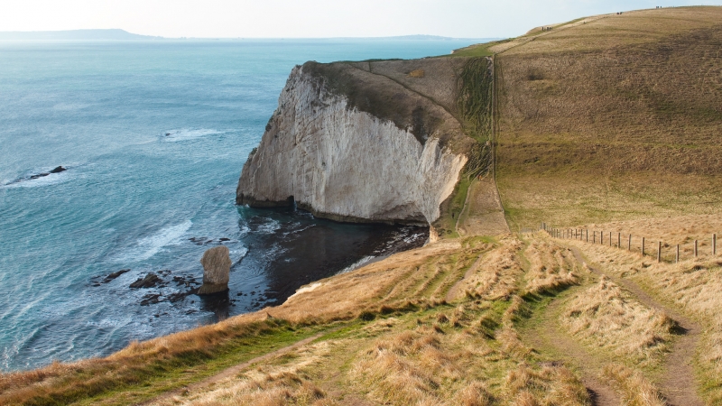
Durdle Door West Beach is a narrow strand of mixed shingle, gravel, and sand, forming part of the Lulworth Estate and the Purbeck Heritage Coast. The beach is approximately 750 metres wide and is backed by high cliffs. The eastern end of the beach, known as Durdle Door Cove, is protected by the magnificent limestone arch, while the rest of the beach is partially sheltered by a submerged offshore reef.
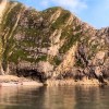
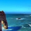
The main feature of this iconic cove is the limestone arch, which separates Durdle Door from Man o'War Bay. The arch was formed by thousands of years of pounding waves sweeping against the headland. The beach is also known for its high limestone cliffs, which are part of the Jurassic Coast, a UNESCO World Heritage Site. Fossils such as ammonites and belemnites can be found along this stretch, although care should be taken under the cliffs due to occasional rock falls.
During the summer months, the crystal-clear waters make the beach a popular spot for swimmers and snorkelers. However, there is no lifeguard, and children need to be closely supervised as the sand in the bay shelves suddenly in places. The beach is also a great spot to relax with a picnic, taking in the spectacular scenery. A pay-and-display car park is available at the cliff top, and toilets with disabled facilities can be found at the nearby Durdle Door Holiday Park from March to October.
The beach is owned by the Welds family, who own 12,000 acres in Dorset in the name of the Lulworth Estate. The beach is open to the public and is a dog-friendly destination all year round. Visitors can reach the beach by walking over the cliff from Lulworth Cove, and the area offers plenty of walks with well-signposted footpaths, including the South West Coast Path.
Durdle Door West Beach is on the Purbeck Heritage Coast and the Jurassic Coast, and adjacent to the South West Coast Path.
Shingle
| Tonight |  |
|---|---|
| Chance of rain | 100% |
| Min temperature | 14°C |
| feels like | 15°C |
| Wind 25mph |  |
| Tomorrow |
 |
|---|---|
| Chance of rain | 80% |
| Max temperature | 14°C |
| feels like | 16°C |
| Wind 18mph |  |
| Max UV Index |  |
The tide at Durdle Door West Beach is currently falling. Low tide will be at approximately 12:40 AM tomorrow, and the next low tide will be at approximately 11:40 PM.
Detailed weather and tides » Campsite
 Food available
 Toilets
 Shops
Shops
 Litter bins
Pay parking at cliff top car park at Durdle Door Holiday Park.
Dogs are allowed.
No lifeguard cover at this beach


Water quality not measured here
less than a mile east as the seagull flies, less than a mile by road.
less than a mile east as the seagull flies, less than a mile by road.
around 2 miles east as the seagull flies, around 2 miles by road.
around 3 miles west as the seagull flies, around 11 miles by road or 3 miles on foot using coastal paths.
around 6 miles west as the seagull flies, around 13 miles by road or 8 miles on foot using coastal paths.
around 6 miles west as the seagull flies, around 13 miles by road or 8 miles on foot using coastal paths.
around 7 miles west as the seagull flies, around 13 miles by road or 9 miles on foot using coastal paths.
around 7 miles east as the seagull flies, around 10 miles by road.
around 7 miles west as the seagull flies, around 14 miles by road or 9 miles on foot using coastal paths.
around 7 miles west as the seagull flies, around 14 miles by road or 10 miles on foot using coastal paths.
around 8 miles west-southwest as the seagull flies, around 16 miles by road or 11 miles on foot using coastal paths.
around 8 miles west-southwest as the seagull flies, around 16 miles by road or 12 miles on foot using coastal paths.
around 8 miles west-southwest as the seagull flies, around 19 miles by road or 15 miles on foot using coastal paths.
around 9 miles southwest as the seagull flies, around 22 miles by road or 17 miles on foot using coastal paths.
around 9 miles west-southwest as the seagull flies, around 17 miles by road or 13 miles on foot using coastal paths.
around 13 miles east-northeast as the seagull flies, around 19 miles by road.
around 13 miles east-northeast as the seagull flies, around 19 miles by road.
around 14 miles east-northeast as the seagull flies, around 18 miles by road.
around 15 miles east as the seagull flies, around 17 miles by road.
around 15 miles east as the seagull flies, around 16 miles by road.
Location: Lulworth Cove
Location type: Rural
OS Grid: SY797804
Coordinates: 50°37'22"N 2°17'15"W
Mapcode: GBR 10P.Y49
What 3 Words: fended.inventors.last
Coordinates and location codes are for an approximate mid-point of the beach, and may not reflect the best access point or the most popular part of the beach.
County: Dorset
Country: England
Local Authority: Purbeck
Parish: Chaldon Herring
Nearest postcode: DT2 8DW
(for sat-nav purposes only, a beach does not have a postal address!)
Important! Beach information is compiled from a variety of different sources and is correct to the best of our knowledge at the time of compilation. However, information may be incorrectly supplied by our sources or go out of date after publication. BritishBeaches.uk makes no warranty as to the accuracy of any information on this page.