Approximate Location Map
Use two fingers to pan or zoom the map
Use two fingers to pan or zoom the map
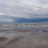
Druridge Bay is a 7-mile stretch of golden sandy shoreline, backed by grassy dunes. The beach runs south from Amble, all the way down to Cresswell. Along this part of the coast, which curves gently around a wide bay, are the remains of pill-boxes and anti-tank blocks, being the remnants of defences placed here during the Second World War.
The central section of the beach can be found down a lane heading east out of Widdrington village. The beach is shallow, wide at low tide, and backed by extensive dunes and surrounded by meadows, woodland, and lakes.
This area of the coast is rich in wildlife, and makes a popular destination for walking or birdwatching. Look out for golden plover and purple sandpipers. The beach is also used by surfers and kite surfers. Additionally, Druridge Bay is a popular beach for horse riding, with riders often seen galloping along the beach.
The stretch of beach running south of the Chevington Burn towards the National Trust land is privately owned, but has been used as an unofficial nudist beach for around 50 years. An annual skinny-dip to raise money for MIND, the mental health charity, has in the past been organised here around dawn at the Autumn Equinox.
There is a pub, serving food in Widdrington. More extensive facilities, including plenty of restaurants and an ice-cream parlour, are to be found in Amble a few miles up the coast. The Druridge Bay Country Park, a nature lover's haven, is located on the northern side of the beach, with trails by a freshwater lake and picnic spots.
The beach is situated near the Northumberland Coast Country Park and the National Trust property, making it a great destination for those looking to explore the local area.
Druridge Bay Central Beach is on the North Northumberland Heritage Coast, and adjacent to the Northumberland Coast Path.
Sand
| Today |  |
|---|---|
| Chance of rain | 100% |
| Max temperature | 13°C |
| feels like | 12°C |
| Wind 17mph |  |
| Max UV Index |  |
| Tonight |  |
|---|---|
| Chance of rain | 56% |
| Min temperature | 13°C |
| feels like | 5°C |
| Wind 20mph |  |
The tide at Druridge Bay Central Beach is currently rising. High tide will be at approximately 4:02 PM, and the next low tide will be at approximately 10:11 PM.
Detailed weather and tides » Campsite
National Trust Car Park.
Dogs are welcome.
No lifeguard cover at this beach

Water quality not measured here
just over a mile south-southeast as the seagull flies, around 2 miles by road.
around 2 miles south-southeast as the seagull flies, around 2 miles by road.
around 2 miles north as the seagull flies, around 7 miles by road or 3 miles on foot using coastal paths.
around 3 miles south-southeast as the seagull flies, around 3 miles by road.
around 4 miles south-southeast as the seagull flies, around 6 miles by road.
around 5 miles north as the seagull flies, around 8 miles by road or 5 miles on foot using coastal paths.
around 5 miles south-southeast as the seagull flies, around 9 miles by road or 6 miles on foot using coastal paths.
around 6 miles south-southeast as the seagull flies, around 9 miles by road or 7 miles on foot using coastal paths.
around 6 miles south-southeast as the seagull flies, around 10 miles by road or 7 miles on foot using coastal paths.
around 6 miles north as the seagull flies, around 10 miles by road.
around 8 miles south-southeast as the seagull flies, around 13 miles by road or 10 miles on foot using coastal paths.
around 8 miles south-southeast as the seagull flies, around 13 miles by road or 10 miles on foot using coastal paths.
around 9 miles north-northwest as the seagull flies, around 13 miles by road.
around 10 miles south-southeast as the seagull flies, around 17 miles by road.
around 12 miles north as the seagull flies, around 17 miles by road.
around 12 miles south-southeast as the seagull flies, around 19 miles by road.
around 15 miles north as the seagull flies, around 20 miles by road.
around 15 miles south-southeast as the seagull flies, around 22 miles by road.
around 16 miles south-southeast as the seagull flies, around 25 miles by road.
around 17 miles south-southeast as the seagull flies, around 25 miles by road.
Location: Druridge
Location type: Village
Nearest village: Widdrington
OS Grid: NZ278961
Coordinates: 55°15'30"N 1°33'45"W
Mapcode: GBR K7JM.GR
What 3 Words: haven.heartless.digitally
Coordinates and location codes are for an approximate mid-point of the beach, and may not reflect the best access point or the most popular part of the beach.
Country: England
Local Authority: Northumberland
Parish: Widdrington Village
Nearest postcode: NE61 5EG
(for sat-nav purposes only, a beach does not have a postal address!)
Important! Beach information is compiled from a variety of different sources and is correct to the best of our knowledge at the time of compilation. However, information may be incorrectly supplied by our sources or go out of date after publication. BritishBeaches.uk makes no warranty as to the accuracy of any information on this page.