Approximate Location Map
Use two fingers to pan or zoom the map
Use two fingers to pan or zoom the map
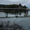
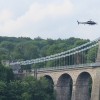
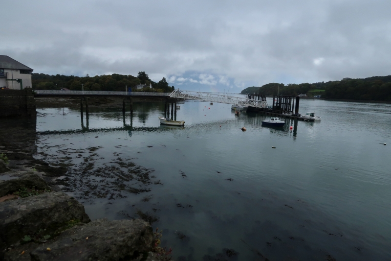
Menai Bridge St Georges Pier Beach is situated underneath the iconic Menai Straits Suspension Bridge, offering picturesque views of the surrounding area. The beach itself is composed of mud and rock, and is a short distance from the town of Beaumaris.
Facilities for visitors can be found at the nearby library, which is open all year round. The beach is a great spot for boat trips, with visits to Puffin Island available from Beaumaris Beach, which is a short distance away. Visitors can also take a stroll along the seafront and pier, enjoying the views of the Menai Straits.
The nearby Beaumaris Castle, which dominates the shore, was built by Edward I and construction began in 1295, although it was never completed. The castle has been designated as a World Heritage site and is one of the finest examples of medieval military architecture.
The beach is dog-friendly, although there are restrictions in place from 1st May to 30th September.
Menai Bridge St Georges Pier Beach is adjacent to the Anglesey Coast Path and the Wales Coast Path.
Rock Mud
| Today |  |
|---|---|
| Chance of rain | 99% |
| Max temperature | 16°C |
| feels like | 17°C |
| Wind 20mph |  |
| Max UV Index |  |
| Tonight |  |
|---|---|
| Chance of rain | 82% |
| Min temperature | 11°C |
| feels like | 13°C |
| Wind 18mph |  |
The tide at Menai Bridge St Georges Pier Beach is currently falling. Low tide will be at approximately 5:06 PM, and the next high tide will be at approximately 10:47 PM.
 Today's air pollution levels are forecast to be Low
 Food available
 Toilets
 Shops
Shops
 Slipway
Parking available next to the beach.
Dogs are allowed.
No lifeguard cover at this beach

Water quality not measured here
around 4 miles southwest as the seagull flies, around 4 miles by road.
around 4 miles northeast as the seagull flies, around 5 miles by road.
around 5 miles southwest as the seagull flies, around 6 miles by road.
around 5 miles north-northwest as the seagull flies, around 7 miles by road.
around 6 miles north as the seagull flies, around 10 miles by road or 7 miles on foot using coastal paths.
around 6 miles north-northwest as the seagull flies, around 8 miles by road.
around 6 miles northeast as the seagull flies, around 7 miles by road.
around 6 miles north-northwest as the seagull flies, around 8 miles by road.
around 7 miles north-northwest as the seagull flies, around 8 miles by road.
around 8 miles east-northeast as the seagull flies, around 12 miles by road.
around 9 miles north-northwest as the seagull flies, around 11 miles by road.
around 10 miles north-northwest as the seagull flies, around 12 miles by road.
around 10 miles east-northeast as the seagull flies, around 14 miles by road.
around 11 miles west-southwest as the seagull flies, around 13 miles by road.
around 12 miles southwest as the seagull flies, around 16 miles by road.
around 13 miles west-southwest as the seagull flies, around 17 miles by road.
around 13 miles east-northeast as the seagull flies, around 18 miles by road.
around 14 miles north-northwest as the seagull flies, around 17 miles by road.
around 14 miles west as the seagull flies, around 18 miles by road.
around 14 miles west as the seagull flies, around 18 miles by road.
Location: Porthaethwy (Menai Bridge)
Location type: Town
OS Grid: SH558719
Coordinates: 53°13'31"N 4°9'37"W
Mapcode: GBR 5N.0XHN
What 3 Words: fanfare.earmarked.famed
Coordinates and location codes are for an approximate mid-point of the beach, and may not reflect the best access point or the most popular part of the beach.
Country: Wales
Local Authority: Isle of Anglesey
Parish: Menai Bridge
Nearest postcode: LL59 5EY
(for sat-nav purposes only, a beach does not have a postal address!)
Important! Beach information is compiled from a variety of different sources and is correct to the best of our knowledge at the time of compilation. However, information may be incorrectly supplied by our sources or go out of date after publication. BritishBeaches.uk makes no warranty as to the accuracy of any information on this page.