Approximate Location Map
Use two fingers to pan or zoom the map
Use two fingers to pan or zoom the map
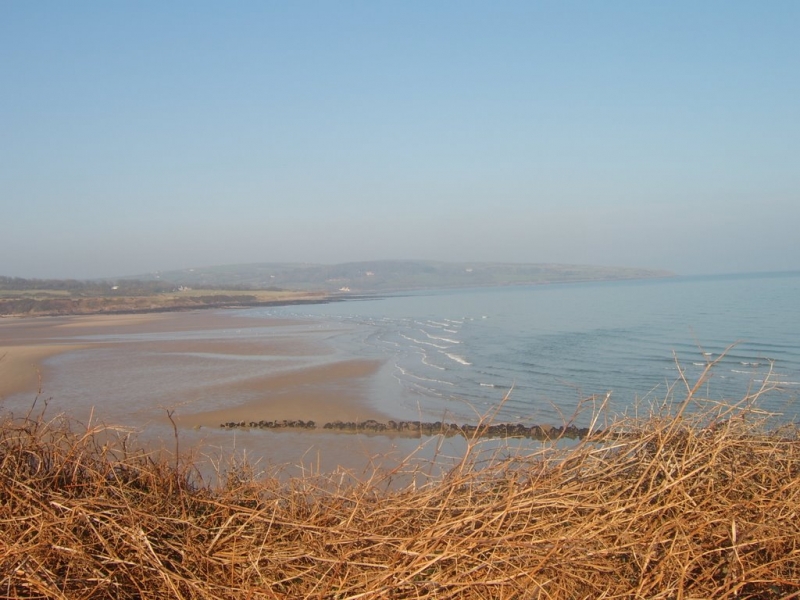
Traeth Lligwy Beach is situated to the north of the village of Moelfre and measures just over 1 kilometre at its widest point. The beach is a relatively sheltered sandy beach, surrounded by limestone rocks and agricultural land, and is located in the Anglesey Area of Outstanding Natural Beauty. Sections of the beach are also designated as the Lligwy Special Site of Scientific Interest.
The beach is backed by low sand dunes, giving it a wild and open feel, and at low tide, a large expanse of firm sand is revealed, providing ample space for beach games and activities. The beach offers a range of standard facilities, including toilets, car parks, and a shop, making it an ideal destination for families.
Traeth Lligwy Beach is popular with water sports enthusiasts, and its conditions make it suitable for windsurfing, kitesurfing, and surfing. The beach's wide, flat sandy surface and panoramic views towards the Great Orme also make it a lovely spot for relaxation and taking in the scenery.
Sand
| Today |  |
|---|---|
| Chance of rain | 100% |
| Max temperature | 16°C |
| feels like | 16°C |
| Wind 32mph |  |
| Max UV Index |  |
| Tonight | |
|---|---|
| Chance of rain | 100% |
| Min temperature | 13°C |
| feels like | 9°C |
| Wind 34mph | |
The tide at Traeth Lligwy Beach is currently high. Low tide will be at approximately 4:46 PM, and the next high tide will be at approximately 10:33 PM.
Detailed weather and tides » Campsite
 Food available
 Toilets
There is a car park near the beach.
Dogs are allowed.
No lifeguard cover at this beach



Excellent water quality
just over a mile east-southeast as the seagull flies, around 2 miles by road.
around 4 miles south-southeast as the seagull flies, around 6 miles by road or 4 miles on foot using coastal paths.
around 4 miles north-northwest as the seagull flies, around 6 miles by road.
around 4 miles southeast as the seagull flies, around 5 miles by road.
around 5 miles south-southeast as the seagull flies, around 5 miles by road.
around 5 miles south-southeast as the seagull flies, around 6 miles by road.
around 6 miles southeast as the seagull flies, around 12 miles by road or 8 miles on foot using coastal paths.
around 6 miles northwest as the seagull flies, around 8 miles by road.
around 9 miles west-northwest as the seagull flies, around 11 miles by road.
around 9 miles west-northwest as the seagull flies, around 11 miles by road.
around 9 miles east-southeast as the seagull flies, around 15 miles by road.
around 10 miles southeast as the seagull flies, around 12 miles by road.
around 10 miles south-southeast as the seagull flies, around 12 miles by road.
around 11 miles west-northwest as the seagull flies, around 13 miles by road.
around 12 miles west as the seagull flies, around 18 miles by road.
around 12 miles south as the seagull flies, around 15 miles by road.
around 13 miles west as the seagull flies, around 18 miles by road.
around 13 miles west as the seagull flies, around 21 miles by road or 17 miles on foot using coastal paths.
around 13 miles south as the seagull flies, around 17 miles by road.
around 13 miles east-southeast as the seagull flies, around 23 miles by road.
Location: Brynrefail
Location type: Rural
OS Grid: SH497873
Coordinates: 53°21'41"N 4°15'33"W
Mapcode: GBR HMVT.9NS
What 3 Words: selects.intrigues.jazzy
Coordinates and location codes are for an approximate mid-point of the beach, and may not reflect the best access point or the most popular part of the beach.
Country: Wales
Local Authority: Isle of Anglesey
Parish: Moelfre
Nearest postcode: LL72 8NN
(for sat-nav purposes only, a beach does not have a postal address!)
Important! Beach information is compiled from a variety of different sources and is correct to the best of our knowledge at the time of compilation. However, information may be incorrectly supplied by our sources or go out of date after publication. BritishBeaches.uk makes no warranty as to the accuracy of any information on this page.