Approximate Location Map
Use two fingers to pan or zoom the map
Use two fingers to pan or zoom the map
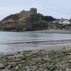
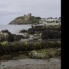
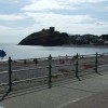
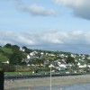
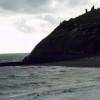
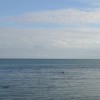
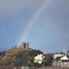
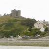
The town of Criccieth sits behind a rocky headland dominated by a 13th-century castle. The beach itself is south-facing, comprising sand and pebble, and is located to the west of Porthmadog. The bathing water lies within the Lleyn Peninsula and the Sarnau Special Area of Conservation.
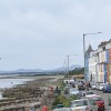
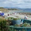
The crescent-shaped beach at Criccieth is sheltered by the rocky headland, providing a gently sloping and excellent family beach. The beach tends to be more shingle towards the castle end, while becoming more sandy as it stretches eastwards into Tremadog Bay. A promenade runs along the back of the beach, offering plenty of access points, many of which are suitable for disabled visitors. The town of Criccieth provides a range of shops, cafes, and pubs.
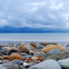
Criccieth East Beach, also referred to as Traeth y Promenade, is one of two beaches in the town of Criccieth. The beach is mainly pebbles, but at low tide, a sandy expanse is exposed. The water is shallow, providing safe swimming conditions, and is warm due to the Gulf Stream passing close by. This beach is ideal for water sports, including kayaking and paddleboarding, and has been awarded the Blue Flag. It is a popular spot for families, with plenty of places to eat and drink nearby.
Dogs are not allowed on the beach immediately in front of the esplanade; however, they are permitted east of the pitch and putt course. On fine days, when the tide is out, visitors can stroll along the beach to Black Rock sands, potentially spotting seals, porpoises, and dolphins.
The beach and surrounding areas have several conservation designations, including the Tiroedd a Glannau Rhwng Cricieth AC Afon Glaslyn Site of Special Scientific Interest to the east, and the Glanllynnau a Glannau Pen-ychain I Cricieth Site of Special Scientific Interest to the west.
Criccieth Beach is adjacent to the Llyn Peninsula Coastal Path and the Wales Coast Path.
Sand Shingle Rock
| Tonight |  |
|---|---|
| Chance of rain | 100% |
| Min temperature | 12°C |
| feels like | 11°C |
| Wind 31mph |  |
| Tomorrow |
 |
|---|---|
| Chance of rain | 42% |
| Max temperature | 13°C |
| feels like | 16°C |
| Wind 24mph |  |
| Max UV Index |  |
The tide at Criccieth Beach is currently falling. Low tide will be at approximately 4:21 AM tomorrow, and the next high tide will be at approximately 9:17 AM tomorrow.
Detailed weather and tides » Food available
 Toilets
 Shops
Shops
 Slipway
There is parking off the Esplanade.
Dogs not allowed.
No lifeguard cover at this beach

Excellent water quality
less than a mile west-southwest as the seagull flies, less than a mile by road.
just over a mile east-southeast as the seagull flies, around 5 miles by road or 2 miles on foot using coastal paths.
around 3 miles east-southeast as the seagull flies, around 9 miles by road or 4 miles on foot using coastal paths.
around 4 miles east as the seagull flies, around 6 miles by road or 5 miles on foot using coastal paths.
around 4 miles west-southwest as the seagull flies, around 5 miles by road.
around 6 miles southeast as the seagull flies, around 15 miles by road.
around 6 miles west-southwest as the seagull flies, around 7 miles by road.
around 7 miles southeast as the seagull flies, around 16 miles by road.
around 8 miles west-southwest as the seagull flies, around 10 miles by road.
around 10 miles northwest as the seagull flies, around 13 miles by road.
around 10 miles north-northwest as the seagull flies, around 14 miles by road.
around 10 miles south-southeast as the seagull flies, around 21 miles by road.
around 11 miles west-southwest as the seagull flies, around 13 miles by road.
around 11 miles south-southeast as the seagull flies, around 21 miles by road.
around 12 miles north-northwest as the seagull flies, around 15 miles by road.
around 13 miles west as the seagull flies, around 16 miles by road.
around 13 miles west as the seagull flies, around 16 miles by road.
around 13 miles west-southwest as the seagull flies, around 16 miles by road.
around 13 miles southwest as the seagull flies, around 17 miles by road.
around 14 miles west as the seagull flies, around 16 miles by road.
Location: Cricieth (Criccieth)
Location type: Town
OS Grid: SH503380
Coordinates: 52°55'7"N 4°13'38"W
Mapcode: GBR 5K.N5KB
What 3 Words: shallower.crackling.angle
Coordinates and location codes are for an approximate mid-point of the beach, and may not reflect the best access point or the most popular part of the beach.
Country: Wales
Local Authority: Gwynedd
Parish: Criccieth
Nearest postcode: LL52 0HW
(for sat-nav purposes only, a beach does not have a postal address!)
Important! Beach information is compiled from a variety of different sources and is correct to the best of our knowledge at the time of compilation. However, information may be incorrectly supplied by our sources or go out of date after publication. BritishBeaches.uk makes no warranty as to the accuracy of any information on this page.