Approximate Location Map
Use two fingers to pan or zoom the map
Use two fingers to pan or zoom the map
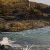
Harlyn Bay is situated on the Eastern side of Trevose Head and features a stretch of sand and pebbles approximately two thirds of a mile long, backed by dunes and surrounded by cliffs towards Cataclews Point, forming Big Guns Cove. The beach is approximately 770 metres wide and is a large, fairly remote sandy beach.
The beach is backed by sand dunes and low cliffs, and the Harlyn Stream flows across the beach. The bay is north-facing and located just to the east of Trevose Head.
Harlyn Bay is a popular destination for families and surfers, with a seasonal lifeguard service provided by the RNLI during the summer season. The beach is suitable for novice surfers and there are surf schools offering lessons and surf board hire on the beach. The bay is also dog-friendly all year round.
An Iron Age cemetery was discovered at Harlyn Bay, and relics can be seen at the Royal Cornwall Museum. There is a holiday and caravan park to the west of the beach, as well as self-catering accommodation options in the village. Parking and a bus stop are available on the beachfront.
Harlyn Bay is adjacent to the South West Coast Path.
Sand
| Today |  |
|---|---|
| Chance of rain | 100% |
| Max temperature | 17°C |
| feels like | 18°C |
| Wind 26mph |  |
| Max UV Index |  |
| Tonight |  |
|---|---|
| Chance of rain | 100% |
| Min temperature | 13°C |
| feels like | 12°C |
| Wind 31mph | |
The tide at Harlyn Bay is currently rising. High tide will be at approximately 5:16 PM, and the next low tide will be at approximately 11:45 PM.
Detailed weather and tides » Food available
 Toilets
 Shops
Shops
There is a large pay car park by the beach.
Beach cleaned regularly.

Daily - 30th April - 25th September
Weekends - 16th - 24th April
Easter - 25th March - 10th April


Water quality not measured here
less than a mile west-northwest as the seagull flies, just over a mile by road.
less than a mile east-northeast as the seagull flies, around 3 miles by road or 2 miles on foot using coastal paths.
just over a mile west as the seagull flies, just over a mile by road.
just over a mile west-southwest as the seagull flies, around 2 miles by road.
around 2 miles southwest as the seagull flies, around 3 miles by road or 2 miles on foot using coastal paths.
around 3 miles south-southwest as the seagull flies, around 3 miles by road.
around 3 miles east-northeast as the seagull flies, around 4 miles by road.
around 5 miles south-southwest as the seagull flies, around 7 miles by road.
around 7 miles south-southwest as the seagull flies, around 9 miles by road.
around 9 miles south-southwest as the seagull flies, around 12 miles by road.
around 9 miles south-southwest as the seagull flies, around 12 miles by road.
around 9 miles south-southwest as the seagull flies, around 12 miles by road.
around 9 miles south-southwest as the seagull flies, around 12 miles by road.
around 9 miles south-southwest as the seagull flies, around 13 miles by road.
around 10 miles south-southwest as the seagull flies, around 14 miles by road.
around 11 miles south-southwest as the seagull flies, around 16 miles by road.
around 12 miles south-southwest as the seagull flies, around 18 miles by road.
around 14 miles south-southwest as the seagull flies, around 20 miles by road.
around 15 miles south-southwest as the seagull flies, around 21 miles by road.
around 18 miles south-southwest as the seagull flies, around 24 miles by road.
Location: Harlyn
Location type: Village
OS Grid: SW876755
Coordinates: 50°32'28"N 4°59'51"W
Mapcode: GBR ZH.ZY51
What 3 Words: groom.outs.ships
Coordinates and location codes are for an approximate mid-point of the beach, and may not reflect the best access point or the most popular part of the beach.
Country: England
Local Authority: Cornwall
Parish: St. Merryn
Nearest postcode: PL28 8YG
(for sat-nav purposes only, a beach does not have a postal address!)
Important! Beach information is compiled from a variety of different sources and is correct to the best of our knowledge at the time of compilation. However, information may be incorrectly supplied by our sources or go out of date after publication. BritishBeaches.uk makes no warranty as to the accuracy of any information on this page.