Approximate Location Map
Use two fingers to pan or zoom the map
Use two fingers to pan or zoom the map
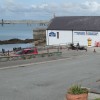
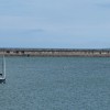
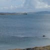
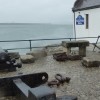
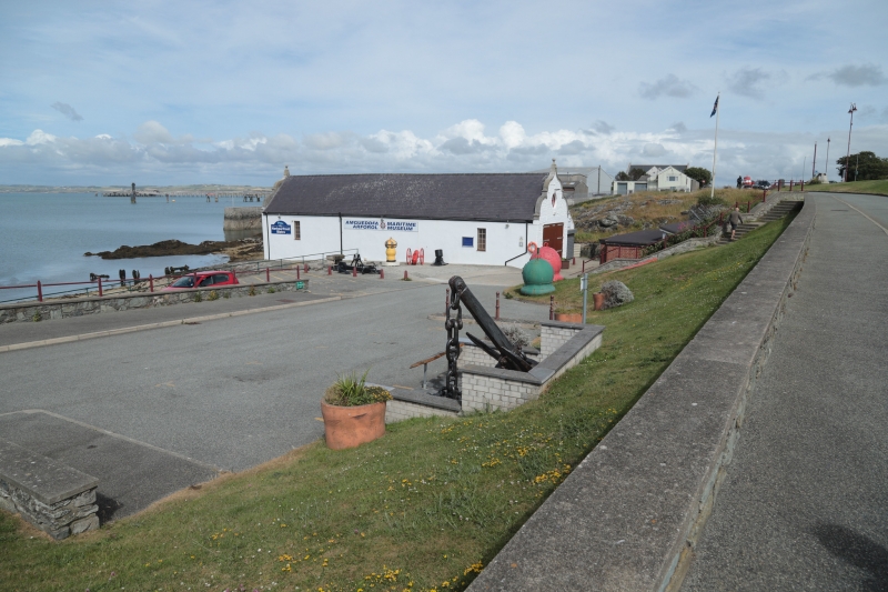
The beach is characterised by a small stretch of shingle and rock, set within the harbour formed by the large breakwater. It is backed by a promenade that runs from the Holyhead Maritime Museum to the sailing club, with a large grassy area situated behind. The beach's location makes it easily accessible, being within a few minutes' walk of the town centre.
The beach has been a popular spot for locals, offering various activities such as dog-walking, rock pooling, and swimming. Its proximity to the Holyhead Maritime Museum and the sailing club also makes it an attractive location for those interested in watersports.
However, the beach's future is currently uncertain due to a proposed major waterfront residential development.
Holyhead Beach is adjacent to the Anglesey Coast Path and the Wales Coast Path.
Harbour Shingle Rock
| Today |  |
|---|---|
| Chance of rain | 100% |
| Max temperature | 15°C |
| feels like | 16°C |
| Wind 38mph |  |
| Max UV Index |  |
| Tonight |  |
|---|---|
| Chance of rain | 80% |
| Min temperature | 11°C |
| feels like | 9°C |
| Wind 41mph |  |
The tide at Holyhead Beach is currently rising. High tide will be at approximately 9:56 PM, and the next low tide will be at approximately 4:06 AM tomorrow.
Detailed weather and tides » Food available
Limited parking available.
Dogs are allowed.
No lifeguard cover at this beach

Water quality not measured here
around 2 miles south-southwest as the seagull flies, around 3 miles by road.
around 3 miles south-southeast as the seagull flies, around 3 miles by road.
around 3 miles east-northeast as the seagull flies, around 11 miles by road.
around 4 miles northeast as the seagull flies, around 13 miles by road.
around 5 miles northeast as the seagull flies, around 14 miles by road.
around 5 miles south-southeast as the seagull flies, around 6 miles by road.
around 6 miles south-southeast as the seagull flies, around 10 miles by road or 7 miles on foot using coastal paths.
around 7 miles southeast as the seagull flies, around 14 miles by road or 10 miles on foot using coastal paths.
around 8 miles southeast as the seagull flies, around 14 miles by road or 11 miles on foot using coastal paths.
around 8 miles northeast as the seagull flies, around 17 miles by road.
around 9 miles southeast as the seagull flies, around 14 miles by road.
around 9 miles southeast as the seagull flies, around 14 miles by road.
around 10 miles southeast as the seagull flies, around 14 miles by road.
around 10 miles northeast as the seagull flies, around 18 miles by road.
around 10 miles northeast as the seagull flies, around 19 miles by road.
around 12 miles southeast as the seagull flies, around 17 miles by road.
around 13 miles northeast as the seagull flies, around 21 miles by road.
around 16 miles east-northeast as the seagull flies, around 24 miles by road.
around 16 miles southeast as the seagull flies, around 24 miles by road.
around 16 miles east-northeast as the seagull flies, around 22 miles by road.
Location: Porth-y-felin, Caergybi
Location type: Urban
OS Grid: SH245832
Coordinates: 53°19'1"N 4°38'5"W
Mapcode: GBR GMXY.5R7
What 3 Words: topples.dogs.growth
Coordinates and location codes are for an approximate mid-point of the beach, and may not reflect the best access point or the most popular part of the beach.
Country: Wales
Local Authority: Isle of Anglesey
Parish: Holyhead
Nearest postcode: LL65 1YB
(for sat-nav purposes only, a beach does not have a postal address!)
Important! Beach information is compiled from a variety of different sources and is correct to the best of our knowledge at the time of compilation. However, information may be incorrectly supplied by our sources or go out of date after publication. BritishBeaches.uk makes no warranty as to the accuracy of any information on this page.