Approximate Location Map
Use two fingers to pan or zoom the map
Use two fingers to pan or zoom the map
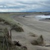
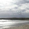
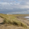
Traeth Llydan Beach is situated on the west coast of Anglesey, measuring approximately 600 metres in length and facing south into Cymyran Bay. The beach is a horseshoe-shaped stretch of sand sheltered by rocky headlands, with a narrow lane between high grassy banks leading down to the beach. The surrounding land is partly forested, contains Silver Bay Holiday Park, and has areas of farmland, with a Royal Air Force base located to the east.
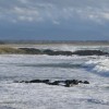
The beach slopes gently into the waters of the bay and features rock formations at either end, providing ample opportunity for rock pooling at low tide. Facilities are limited to a handful of picnic benches and bins beside a small basic hut, with no lifeguard presence. Dogs are permitted throughout the year. Visitors can access the beach via a narrow lane or by foot along the coast path, with the latter being the only option for those not staying at the nearby holiday village.
The bathing water is located in the Anglesey Area of Outstanding Natural Beauty and lies between the Beddmanarch-Cymyran Site of Special Scientific Interest and the Glannau Rhoscolyn Site of Special Scientific Interest. The beach's location and limited access contribute to its uncrowded atmosphere, making it a peaceful spot for those who do manage to visit. However, the tranquillity of the beach can be broken by the take-offs and landings at the neighbouring RAF Valley aerodrome.
Traeth Llydan Beach is adjacent to the Anglesey Coast Path and the Wales Coast Path.
Sand
| Today |  |
|---|---|
| Chance of rain | 100% |
| Max temperature | 16°C |
| feels like | 17°C |
| Wind 32mph |  |
| Max UV Index |  |
| Tonight | |
|---|---|
| Chance of rain | 100% |
| Min temperature | 13°C |
| feels like | 9°C |
| Wind 37mph |  |
The tide at Traeth Llydan Beach is currently falling. Low tide will be at approximately 3:44 PM, and the next high tide will be at approximately 9:31 PM.
Detailed weather and tides » Campsite
There is a car park next to the beach.
Dogs are allowed.
No lifeguard cover at this beach



Excellent water quality
just over a mile west as the seagull flies, around 3 miles by road or 2 miles on foot using coastal paths.
around 2 miles east-southeast as the seagull flies, around 14 miles by road or 9 miles on foot using coastal paths.
around 3 miles southeast as the seagull flies, around 13 miles by road or 9 miles on foot using coastal paths.
around 3 miles northwest as the seagull flies, around 4 miles by road.
around 3 miles southeast as the seagull flies, around 13 miles by road or 10 miles on foot using coastal paths.
around 3 miles southeast as the seagull flies, around 13 miles by road or 10 miles on foot using coastal paths.
around 4 miles southeast as the seagull flies, around 13 miles by road.
around 5 miles northwest as the seagull flies, around 6 miles by road.
around 6 miles north-northwest as the seagull flies, around 10 miles by road or 7 miles on foot using coastal paths.
around 6 miles north as the seagull flies, around 10 miles by road.
around 6 miles southeast as the seagull flies, around 17 miles by road.
around 8 miles north as the seagull flies, around 11 miles by road.
around 9 miles north as the seagull flies, around 13 miles by road.
around 10 miles southeast as the seagull flies, around 24 miles by road.
around 11 miles north as the seagull flies, around 15 miles by road.
around 12 miles north-northeast as the seagull flies, around 16 miles by road.
around 13 miles north-northeast as the seagull flies, around 17 miles by road.
around 14 miles east-southeast as the seagull flies, around 27 miles by road.
around 15 miles north-northeast as the seagull flies, around 20 miles by road.
around 15 miles southeast as the seagull flies, around 36 miles by road.
Location: Pentre Gwyddel
Location type: Rural
Nearest village: Rhoscolyn
OS Grid: SH290752
Coordinates: 53°14'47"N 4°33'48"W
Mapcode: GBR HN33.VSL
What 3 Words: scoop.rudder.believer
Coordinates and location codes are for an approximate mid-point of the beach, and may not reflect the best access point or the most popular part of the beach.
Country: Wales
Local Authority: Isle of Anglesey
Parish: Rhoscolyn
Nearest postcode: LL65 2RZ
(for sat-nav purposes only, a beach does not have a postal address!)
Important! Beach information is compiled from a variety of different sources and is correct to the best of our knowledge at the time of compilation. However, information may be incorrectly supplied by our sources or go out of date after publication. BritishBeaches.uk makes no warranty as to the accuracy of any information on this page.