Approximate Location Map
Use two fingers to pan or zoom the map
Use two fingers to pan or zoom the map
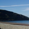
Fairbourne Beach is a two-mile stretch of sand backed by steep pebble banks and surrounded by the Snowdonia National Park. The beach is a 5-kilometre stretch of sand, backed by a large embankment of pebbles, which provides a natural and effective flood defence. At the north of the beach is the Mawddach Estuary, whilst the south is backed by steep cliffs.
The northern end of the beach is designated as part of the Mawddach Estuary Site of Special Scientific Interest, whilst the area to the south of the beach is designated the Glannau Tonfanau I Friog Site of Special Scientific Interest. The bathing water lies within the Lleyn Peninsula and the Sarnau Special Area of Conservation. A short distance along the shore are tank traps dating from the Second World War, known locally as "Dragon's Teeth".
The seaside village of Fairbourne has plenty of amenities and attractions, and there is sufficient access to the beach for those visitors with prams and wheelchairs. At high tide, the beach is mainly composed of sloping pebbled banks backed by grassy dunes, but when the tide is out, a two-mile stretch of golden sand is exposed. From the beach, there are lovely views out into the Irish Sea, contrasting beautifully with the Snowdonia Mountains inland.
Fairbourne Beach is great for water sports, including windsurfing, surfing, and sailing. Golfers can enjoy a round with stunning sea views at the Fairbourne Golf Club. A narrow-gauge heritage miniature railway operates during the summer season, linking to a passenger ferry which takes day trippers across the estuary to Barmouth.
Fairbourne Beach is adjacent to the Meirionnydd Coast Walk and the Wales Coast Path.
Estuary Sand Rock
| Today |  |
|---|---|
| Chance of rain | 85% |
| Max temperature | 18°C |
| feels like | 20°C |
| Wind 11mph |  |
| Max UV Index |  |
| Tonight | |
|---|---|
| Chance of rain | 89% |
| Min temperature | 16°C |
| feels like | 16°C |
| Wind 16mph | |
The tide at Fairbourne Beach is currently falling. Low tide will be at approximately 4:56 AM, and the next high tide will be at approximately 9:53 AM.
 Today's air pollution levels are forecast to be Low
 Campsite
 Food available
 Toilets
 Shops
Shops
 Slipway
Parking available near the beach.
Dog restrictions apply.
No lifeguard cover at this beach


Excellent water quality
around 2 miles north as the seagull flies, around 14 miles by road or 3 miles on foot using coastal paths.
around 2 miles southwest as the seagull flies, around 3 miles by road.
around 5 miles north-northwest as the seagull flies, around 19 miles by road or 8 miles on foot using coastal paths.
around 7 miles north-northwest as the seagull flies, around 20 miles by road or 9 miles on foot using coastal paths.
around 8 miles south-southwest as the seagull flies, around 12 miles by road.
around 10 miles north-northwest as the seagull flies, around 24 miles by road or 14 miles on foot using coastal paths.
around 11 miles south as the seagull flies, around 15 miles by road.
around 12 miles north-northwest as the seagull flies, around 25 miles by road or 17 miles on foot using coastal paths.
around 12 miles south as the seagull flies, around 38 miles by road or 28 miles on foot using coastal paths.
around 13 miles south as the seagull flies, around 38 miles by road or 28 miles on foot using coastal paths.
around 14 miles south as the seagull flies, around 39 miles by road or 29 miles on foot using coastal paths.
around 15 miles north-northwest as the seagull flies, around 36 miles by road or 27 miles on foot using coastal paths.
around 15 miles north-northwest as the seagull flies, around 33 miles by road or 26 miles on foot using coastal paths.
around 16 miles north-northwest as the seagull flies, around 36 miles by road.
around 17 miles north-northwest as the seagull flies, around 36 miles by road.
around 17 miles north-northwest as the seagull flies, around 37 miles by road.
around 18 miles south as the seagull flies, around 43 miles by road or 33 miles on foot using coastal paths.
around 18 miles northwest as the seagull flies, around 41 miles by road.
around 18 miles south as the seagull flies, around 43 miles by road or 34 miles on foot using coastal paths.
around 19 miles northwest as the seagull flies, around 43 miles by road.
Location: Fairbourne
Location type: Village
OS Grid: SH610131
Coordinates: 52°41'52"N 4°3'27"W
Mapcode: GBR 8S.35M8
What 3 Words: reach.transmit.saturate
Coordinates and location codes are for an approximate mid-point of the beach, and may not reflect the best access point or the most popular part of the beach.
Country: Wales
Local Authority: Gwynedd
Parish: Arthog
Nearest postcode: LL38 2DX
(for sat-nav purposes only, a beach does not have a postal address!)
Important! Beach information is compiled from a variety of different sources and is correct to the best of our knowledge at the time of compilation. However, information may be incorrectly supplied by our sources or go out of date after publication. BritishBeaches.uk makes no warranty as to the accuracy of any information on this page.