Approximate Location Map
Use two fingers to pan or zoom the map
Use two fingers to pan or zoom the map
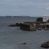
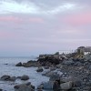
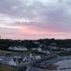
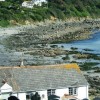
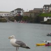
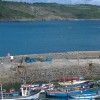
Coverack Beach is situated in a fishing village and consists of a shelving strip of shingle along the bay to the harbour wall. The beach is approximately 790 metres wide and is backed by the fishing village of Coverack. The beach is a mix of sand and pebbles, making it a popular spot for families.
The beach is popular for various activities, including diving, due to the presence of the Manacles, a group of treacherous rocks where numerous boats have been wrecked. The beach also has a rich smuggling history, and its location makes it an ideal spot for anglers. Visitors can also enjoy excellent cliff walks in the surrounding area.
Coverack was once a busy pilchard port, and its history is still evident in the village and beach. The Paris Hotel, located in the village, was named after the SS Paris, which sank nearby in 1899.
Coverack Beach is adjacent to the South West Coast Path.
Sand Shingle Pebbles Rock
| Tonight |  |
|---|---|
| Chance of rain | 100% |
| Min temperature | 12°C |
| feels like | 11°C |
| Wind 20mph |  |
| Tomorrow |
 |
|---|---|
| Chance of rain | 100% |
| Max temperature | 16°C |
| feels like | 12°C |
| Wind 31mph |  |
| Max UV Index |  |
The tide at Coverack Beach is currently falling. Low tide will be at approximately 12:00 AM tomorrow, and the next high tide will be at approximately 5:47 AM tomorrow.
Detailed weather and tides » Toilets
 Litter bins
There is a pay and display car park near the beach.
Dogs are allowed.
The beach is cleaned by the council.
No lifeguard cover at this beach


Water quality not measured here
around 3 miles north-northeast as the seagull flies, around 4 miles by road.
around 3 miles west-southwest as the seagull flies, around 7 miles by road or 4 miles on foot using coastal paths.
around 3 miles north-northeast as the seagull flies, around 5 miles by road.
around 4 miles north-northeast as the seagull flies, around 6 miles by road.
around 4 miles southwest as the seagull flies, around 8 miles by road or 6 miles on foot using coastal paths.
around 5 miles southwest as the seagull flies, around 11 miles by road or 8 miles on foot using coastal paths.
around 7 miles southwest as the seagull flies, around 12 miles by road or 9 miles on foot using coastal paths.
around 7 miles west-southwest as the seagull flies, around 11 miles by road or 9 miles on foot using coastal paths.
around 7 miles west as the seagull flies, around 12 miles by road.
around 7 miles west as the seagull flies, around 12 miles by road.
around 8 miles west as the seagull flies, around 13 miles by road.
around 8 miles west as the seagull flies, around 13 miles by road.
around 8 miles west as the seagull flies, around 13 miles by road.
around 10 miles west-northwest as the seagull flies, around 14 miles by road.
around 13 miles west-northwest as the seagull flies, around 17 miles by road.
around 14 miles west-northwest as the seagull flies, around 17 miles by road.
around 14 miles west-northwest as the seagull flies, around 18 miles by road.
around 17 miles west-northwest as the seagull flies, around 20 miles by road.
around 18 miles west-northwest as the seagull flies, around 21 miles by road.
around 18 miles west-northwest as the seagull flies, around 21 miles by road.
Location: Coverack
Location type: Village
OS Grid: SW782183
Coordinates: 50°1'25"N 5°5'49"W
Mapcode: GBR ZC.RN92
What 3 Words: reissued.troll.taxed
Coordinates and location codes are for an approximate mid-point of the beach, and may not reflect the best access point or the most popular part of the beach.
Country: England
Local Authority: Cornwall
Parish: St. Keverne
Nearest postcode: TR12 6TA
(for sat-nav purposes only, a beach does not have a postal address!)
Important! Beach information is compiled from a variety of different sources and is correct to the best of our knowledge at the time of compilation. However, information may be incorrectly supplied by our sources or go out of date after publication. BritishBeaches.uk makes no warranty as to the accuracy of any information on this page.