Approximate Location Map
Use two fingers to pan or zoom the map
Use two fingers to pan or zoom the map
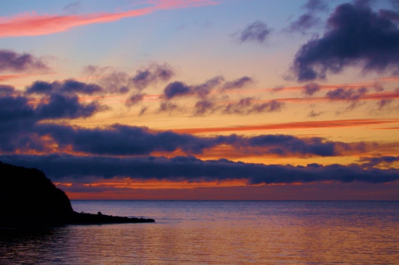
Little Quay Beach is situated within Little Quay Bay, between New Quay and Aberaeron. The beach is sheltered and generally quiet, offering stunning views over the sea and out to Cardigan Bay. The bay is surrounded by picturesque countryside and is close to a heritage coastal path, which provides scenic walks to Aberaeron and other nearby attractions.
The area is renowned for its wildlife, with red kites frequently spotted in the vicinity. Visitors to Cardigan Bay may also catch a glimpse of dolphins or seals swimming in the bay. The beach is an ideal spot for sunset viewing, with many visitors drawn to the area for this purpose. At low tide, it is possible to walk to New Quay Harbour, a 20-minute stroll.
The nearby village of New Quay offers a range of amenities, including bars, restaurants, and cafes. Visitors can also take a boat trip from the harbour to spot seals and dolphins. The area has literary connections, with the poet Dylan Thomas having regularly holidayed in New Quay. A trail dedicated to his life can be found in the area. Other nearby attractions include the New Quay Honey Farm, where visitors can learn about beekeeping and honey production.
The beach is also known as Cei Bach Beach and is located near the village of Cei Bach, just south of Aberaeron in Ceredigion, Wales.
Accessing Little Quay Beach involves a short walk from the nearby parking area, which is typically available along the road. There are no formal facilities directly on the beach, so visitors should come prepared with any necessary supplies.
Little Quay Beach is adjacent to the Ceredigion Coast Path and the Wales Coast Path.
Sand Shingle
| Today |  |
|---|---|
| Chance of rain | 100% |
| Max temperature | 15°C |
| feels like | 16°C |
| Wind 24mph |  |
| Max UV Index |  |
| Tonight | |
|---|---|
| Chance of rain | 100% |
| Min temperature | 11°C |
| feels like | 7°C |
| Wind 30mph |  |
The tide at Little Quay Beach is currently falling. Low tide will be at approximately 2:50 AM, and the next high tide will be at approximately 8:19 AM.
Detailed weather and tides » Campsite
 Food available
 Toilets
 Slipway
Parking available a short walk from the beach.
Dogs are allowed.
No lifeguard cover at this beach

Water quality not measured here
less than a mile west as the seagull flies, less than a mile by road.
just over a mile west as the seagull flies, around 3 miles by road or just over a mile on foot using coastal paths.
just over a mile west as the seagull flies, around 3 miles by road or just over a mile on foot using coastal paths.
just over a mile west as the seagull flies, around 3 miles by road or 2 miles on foot using coastal paths.
just over a mile west as the seagull flies, around 3 miles by road.
around 2 miles northeast as the seagull flies, around 5 miles by road or 2 miles on foot using coastal paths.
around 3 miles northeast as the seagull flies, around 6 miles by road or 4 miles on foot using coastal paths.
around 3 miles northeast as the seagull flies, around 7 miles by road or 5 miles on foot using coastal paths.
around 4 miles west-southwest as the seagull flies, around 6 miles by road or 5 miles on foot using coastal paths.
around 4 miles northeast as the seagull flies, around 7 miles by road or 5 miles on foot using coastal paths.
around 5 miles northeast as the seagull flies, around 8 miles by road or 6 miles on foot using coastal paths.
around 7 miles west-southwest as the seagull flies, around 12 miles by road or 9 miles on foot using coastal paths.
around 7 miles west-southwest as the seagull flies, around 12 miles by road or 9 miles on foot using coastal paths.
around 7 miles northeast as the seagull flies, around 11 miles by road.
around 8 miles northeast as the seagull flies, around 11 miles by road.
around 9 miles southwest as the seagull flies, around 12 miles by road.
around 9 miles northeast as the seagull flies, around 14 miles by road.
around 10 miles southwest as the seagull flies, around 14 miles by road.
around 11 miles west-southwest as the seagull flies, around 15 miles by road.
around 14 miles west-southwest as the seagull flies, around 20 miles by road.
Location: Cei-bach
Location type: Rural
Nearest village: Gilfachreda
OS Grid: SN410597
Coordinates: 52°12'46"N 4°19'40"W
Mapcode: GBR DF.2P42
What 3 Words: winds.edits.refreshed
Coordinates and location codes are for an approximate mid-point of the beach, and may not reflect the best access point or the most popular part of the beach.
Country: Wales
Local Authority: Ceredigion
Parish: Llanllwchaiarn
Nearest postcode: SA45 9SL
(for sat-nav purposes only, a beach does not have a postal address!)
Important! Beach information is compiled from a variety of different sources and is correct to the best of our knowledge at the time of compilation. However, information may be incorrectly supplied by our sources or go out of date after publication. BritishBeaches.uk makes no warranty as to the accuracy of any information on this page.