Approximate Location Map
Use two fingers to pan or zoom the map
Use two fingers to pan or zoom the map
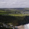
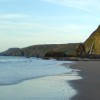
The small resort of Tresaith overlooks this attractive sandy beach and the waters of Cardigan Bay. The name Tresaith is derived from the River Saith which cascades over the cliffs to Tresaith Beach. Facing north west, the bay is popular for swimming, surfing, sailing, and windsurfing as well as beach games and sandcastle building.
The picturesque village behind the beach has a shop, cafe, and pub. The coastal waters and coastal belt is within the Cardigan Bay Special Area of Conservation, confirming the high conservation status of the area. The Ceredigion Coast Path links Tresaith to neighbouring Aberporth and, at low tide, it is possible to walk along the foreshore all the way to the golden beaches of Penbryn, to the north. Walkers are often rewarded with sightings of seals and dolphins close to the shore.
Tresaith is a popular location for a range of water sports; it can be a good surfing beach but it is most popular for sailing with a well-established club and slipway. Access involves a short walk or drive down to the beach, with about 80 steps leading directly to the beach front. Lifeguards patrol the beach during the summer months, ensuring safety for swimmers and beachgoers.
Tresaith Waterfall is a stunning natural feature where the River Saith cascades dramatically over the cliffs, creating a picturesque setting. There are also plenty of rock pools to explore at either end of the beach. A smaller beach is located just around from the waterfall at the northern end of the beach, but access is only possible at low tide. Dogs are allowed on Tresaith Beach year-round, but restrictions apply to one side of the beach from May 1 to September 30, where dogs are not permitted.
Tresaith Beach is adjacent to the Ceredigion Coast Path and the Wales Coast Path.
Bay Sand
| Today |  |
|---|---|
| Chance of rain | 100% |
| Max temperature | 16°C |
| feels like | 17°C |
| Wind 28mph |  |
| Max UV Index |  |
| Tonight | |
|---|---|
| Chance of rain | 100% |
| Min temperature | 12°C |
| feels like | 8°C |
| Wind 34mph |  |
The tide at Tresaith Beach is currently falling. Low tide will be at approximately 2:52 PM, and the next high tide will be at approximately 8:30 PM.
Detailed weather and tides » Campsite
 Food available
 Toilets
 Shops
Shops
 Slipway
Free car parking is available for a few cars.
Dogs not allowed on the southern part of the beach.
Beach cleaned daily during the summer and weekly the rest of the year.

Daily - 18th June - 4th September



Excellent water quality
just over a mile northeast as the seagull flies, around 2 miles by road.
just over a mile west as the seagull flies, around 2 miles by road.
around 3 miles northeast as the seagull flies, around 4 miles by road.
around 3 miles northeast as the seagull flies, around 4 miles by road.
around 5 miles west as the seagull flies, around 7 miles by road.
around 6 miles northeast as the seagull flies, around 11 miles by road or 8 miles on foot using coastal paths.
around 7 miles west as the seagull flies, around 11 miles by road.
around 7 miles west-southwest as the seagull flies, around 11 miles by road.
around 8 miles west-southwest as the seagull flies, around 10 miles by road.
around 8 miles west-southwest as the seagull flies, around 12 miles by road.
around 9 miles northeast as the seagull flies, around 15 miles by road or 11 miles on foot using coastal paths.
around 9 miles northeast as the seagull flies, around 15 miles by road or 11 miles on foot using coastal paths.
around 9 miles northeast as the seagull flies, around 15 miles by road or 11 miles on foot using coastal paths.
around 9 miles northeast as the seagull flies, around 15 miles by road or 11 miles on foot using coastal paths.
around 9 miles northeast as the seagull flies, around 14 miles by road.
around 10 miles northeast as the seagull flies, around 14 miles by road.
around 11 miles northeast as the seagull flies, around 15 miles by road.
around 13 miles northeast as the seagull flies, around 17 miles by road.
around 13 miles northeast as the seagull flies, around 17 miles by road.
around 14 miles northeast as the seagull flies, around 17 miles by road.
Location: Tresaith
Location type: Village
OS Grid: SN278516
Coordinates: 52°8'10"N 4°31'1"W
Mapcode: GBR D5.7J8N
What 3 Words: shining.swipes.parsnip
Coordinates and location codes are for an approximate mid-point of the beach, and may not reflect the best access point or the most popular part of the beach.
Country: Wales
Local Authority: Ceredigion
Parish: Penbryn
Nearest postcode: SA43 2JL
(for sat-nav purposes only, a beach does not have a postal address!)
Important! Beach information is compiled from a variety of different sources and is correct to the best of our knowledge at the time of compilation. However, information may be incorrectly supplied by our sources or go out of date after publication. BritishBeaches.uk makes no warranty as to the accuracy of any information on this page.