Approximate Location Map
Use two fingers to pan or zoom the map
Use two fingers to pan or zoom the map
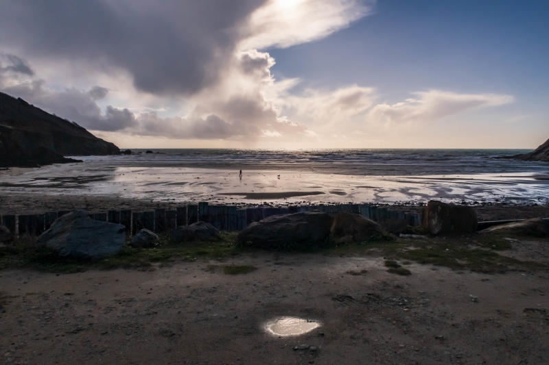
Porthluney Beach is a sheltered sandy cove, approximately 380 metres wide, situated in front of Caerhays Castle and Gardens. The beach is privately owned and is part of the Caerhays estate. It is a remote beach, popular with families, and offers a range of amenities.
The beach boasts a long stretch of soft, golden sand that is ideal for sunbathing, picnicking, and building sandcastles. The gently sloping beach and shallow waters make it exceptionally safe for younger visitors. The cove is overlooked by Caerhays Castle, which is open for visits at certain times, offering a perfect complement to a day at the beach. A small café is located on the left side of the beach, serving refreshments and snacks throughout the summer.
The clear, calm waters are perfect for swimming, kayaking, and stand-up paddleboarding (SUP). However, it is worth noting that the water quality has been somewhat lacking in recent years, and swimming is not always advised.
The beach has easy access, and visitors can enjoy a range of facilities, including a café and dog-friendly areas. Dogs are welcome all year round, but from April to October, they must be kept on leads when the beach gets busy.
Porthluney Beach is on The Roseland Heritage Coast, and adjacent to the South West Coast Path.
Sand
| Tonight |  |
|---|---|
| Chance of rain | 99% |
| Min temperature | 11°C |
| feels like | 10°C |
| Wind 20mph |  |
| Tomorrow |
|
|---|---|
| Chance of rain | 100% |
| Max temperature | 16°C |
| feels like | 12°C |
| Wind 31mph |  |
| Max UV Index |  |
The tide at Porthluney Beach is currently falling. Low tide will be at approximately 12:09 AM tomorrow, and the next high tide will be at approximately 6:07 AM tomorrow.
Detailed weather and tides » Food available
 Toilets
 Shops
Shops
 Litter bins
Large car park available by the beach.
Dogs are allowed but must be kept on the lead during the bathing season.
No lifeguard cover at this beach

Water quality not measured here
less than a mile west as the seagull flies, around 3 miles by road or just over a mile on foot using coastal paths.
just over a mile east-southeast as the seagull flies, around 2 miles by road.
around 2 miles east as the seagull flies, around 4 miles by road.
around 2 miles east as the seagull flies, around 4 miles by road.
around 2 miles east as the seagull flies, around 4 miles by road.
around 2 miles west-southwest as the seagull flies, around 6 miles by road or 3 miles on foot using coastal paths.
around 3 miles northeast as the seagull flies, around 4 miles by road.
around 4 miles northeast as the seagull flies, around 6 miles by road or 5 miles on foot using coastal paths.
around 4 miles northeast as the seagull flies, around 6 miles by road or 5 miles on foot using coastal paths.
around 4 miles northeast as the seagull flies, around 7 miles by road.
around 5 miles west-southwest as the seagull flies, around 8 miles by road or 5 miles on foot using coastal paths.
around 5 miles west-southwest as the seagull flies, around 8 miles by road or 6 miles on foot using coastal paths.
around 6 miles west-southwest as the seagull flies, around 10 miles by road or 8 miles on foot using coastal paths.
around 7 miles west-southwest as the seagull flies, around 10 miles by road or 8 miles on foot using coastal paths.
around 7 miles north-northeast as the seagull flies, around 10 miles by road.
around 7 miles southwest as the seagull flies, around 11 miles by road or 9 miles on foot using coastal paths.
around 7 miles north-northeast as the seagull flies, around 11 miles by road.
around 8 miles north-northeast as the seagull flies, around 11 miles by road.
around 8 miles north-northeast as the seagull flies, around 11 miles by road.
around 8 miles southwest as the seagull flies, around 13 miles by road.
Location: Tregavarras
Location type: Rural
Nearest village: Gorran Churchtown
OS Grid: SW973412
Coordinates: 50°14'10"N 4°50'32"W
Mapcode: GBR ZT.W9B3
What 3 Words: glorious.driftwood.proven
Coordinates and location codes are for an approximate mid-point of the beach, and may not reflect the best access point or the most popular part of the beach.
Country: England
Local Authority: Cornwall
Parish: St. Michael Caerhays
Nearest postcode: PL26 6LF
(for sat-nav purposes only, a beach does not have a postal address!)
Important! Beach information is compiled from a variety of different sources and is correct to the best of our knowledge at the time of compilation. However, information may be incorrectly supplied by our sources or go out of date after publication. BritishBeaches.uk makes no warranty as to the accuracy of any information on this page.