Approximate Location Map
Use two fingers to pan or zoom the map
Use two fingers to pan or zoom the map
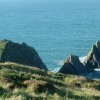
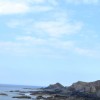
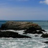
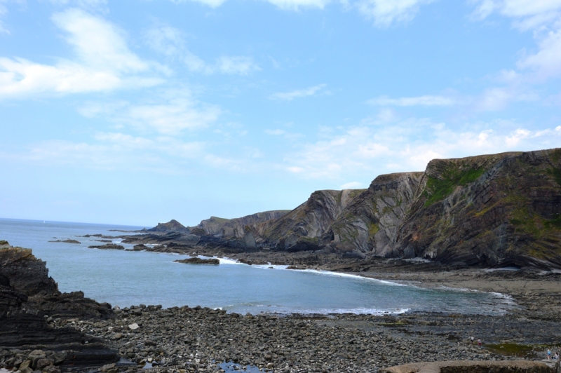
Hartland Quay Beach is located on the north coast of Devon, near the border with Cornwall, and is part of the Hartland Devon Heritage Coast. The beach is approximately 1.2 kilometres wide and is characterised by a mix of pebbles, rocks, and sand, which is exposed as the tide retreats.
The beach is backed by spectacular cliffs with waterfalls from a small stream, and features coves, rock pools, and many bird's nests. On a calm day, the beach is suitable for bathing, snorkelling, surfing, and fishing. Visitors can also explore the nearby Hartland Quay Museum, which tells the story of the area's legends, history, and shipwrecks.
A large car park is located on the cliffs above the quay, and the beach is accessed via a slipway, although this is not suitable for wheelchair access. There is also a hotel and restaurant in a picturesque spot at the top of the cliffs, overlooking the beach and surrounding coastline, as well as toilets.
The South West Coast Path passes the beach, offering spectacular views, but warning signs advise of the dangers of the cliffs. Visitors can take a circular walk to Hartland Point to the north, or walk to the nearby Spekes Mill Mouth waterfall to the south. The area is infamous for shipwrecks, and care should be taken when exploring the coastline.
The Hartland Quay area is designated as a 'Heritage Coastline' and an 'Area of Outstanding Natural Beauty', reflecting its unique geological and natural significance.
In March 2017, the beach gained notoriety when the carcass of an enormous whale washed up on the rocks.
Hartland Quay Beach is on the Hartland (Devon) Heritage Coast, and adjacent to the South West Coast Path.
Pebbles Rock
| Today |  |
|---|---|
| Chance of rain | 99% |
| Max temperature | 16°C |
| feels like | 17°C |
| Wind 31mph |  |
| Max UV Index |  |
| Tonight |  |
|---|---|
| Chance of rain | 100% |
| Min temperature | 14°C |
| feels like | 11°C |
| Wind 36mph |  |
The tide at Hartland Quay Beach is currently rising. High tide will be at approximately 6:17 AM, and the next low tide will be at approximately 12:43 PM.
Detailed weather and tides » Food available
 Toilets
 Shops
Shops
 Slipway
There is pay parking for 50 cars.
Dogs are not allowed on this beach all year.
Beach cleaned as required.
No lifeguard cover at this beach


Water quality not measured here
around 2 miles northeast as the seagull flies, around 4 miles by road.
around 4 miles south as the seagull flies, around 8 miles by road or 6 miles on foot using coastal paths.
around 6 miles east as the seagull flies, around 8 miles by road.
around 9 miles south as the seagull flies, around 16 miles by road or 12 miles on foot using coastal paths.
around 10 miles south as the seagull flies, around 18 miles by road or 13 miles on foot using coastal paths.
around 11 miles south as the seagull flies, around 18 miles by road or 14 miles on foot using coastal paths.
around 11 miles south as the seagull flies, around 19 miles by road or 14 miles on foot using coastal paths.
around 13 miles east-northeast as the seagull flies, around 17 miles by road.
around 14 miles east-northeast as the seagull flies, around 18 miles by road.
around 14 miles south as the seagull flies, around 21 miles by road or 17 miles on foot using coastal paths.
around 14 miles south as the seagull flies, around 21 miles by road.
around 15 miles east-northeast as the seagull flies, around 34 miles by road.
around 16 miles northeast as the seagull flies, around 34 miles by road.
around 17 miles northeast as the seagull flies, around 36 miles by road.
around 18 miles south-southwest as the seagull flies, around 28 miles by road.
around 19 miles northeast as the seagull flies, around 40 miles by road.
around 19 miles northeast as the seagull flies, around 40 miles by road.
around 20 miles northeast as the seagull flies, around 40 miles by road.
around 22 miles south-southwest as the seagull flies, around 31 miles by road.
around 23 miles northeast as the seagull flies, around 38 miles by road.
Location: Stoke
Location type: Rural
OS Grid: SS224248
Coordinates: 50°59'45"N 4°31'55"W
Mapcode: GBR K2.KKRY
What 3 Words: grading.tools.whisker
Coordinates and location codes are for an approximate mid-point of the beach, and may not reflect the best access point or the most popular part of the beach.
County: Devon
Country: England
Local Authority: Torridge
Parish: Hartland
Nearest postcode: EX39 6DB
(for sat-nav purposes only, a beach does not have a postal address!)
Important! Beach information is compiled from a variety of different sources and is correct to the best of our knowledge at the time of compilation. However, information may be incorrectly supplied by our sources or go out of date after publication. BritishBeaches.uk makes no warranty as to the accuracy of any information on this page.