Approximate Location Map
Use two fingers to pan or zoom the map
Use two fingers to pan or zoom the map
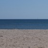
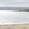
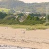
Par Beach is a large sandy beach resort, approximately one kilometre wide, backed by sand dunes and situated near Par Harbour. The Polmear Stream flows across the beach into the sea, adding to the natural charm of the area. The beach is bordered by a brackish lagoon and offers a safe and sandy environment, making it an ideal spot for families.
The beach is a vast and beautiful stretch of golden sand, extending nearly half a mile out to sea at low tide. This wide, flat beach is perfect for long walks, sandcastle building, or simply spreading out to soak up the sun. The beach is backed by picturesque dunes, providing a beautiful backdrop for a day at the beach. Visitors can enjoy swimming, paddling, and sunbathing, although there is no lifeguard cover. However, the beach's gradual descent into the sea makes it a popular choice for families with children.
Getting to Par Beach is convenient, with a large pay-and-display car park located next to the beach. There is also a disabled access ramp, ensuring that everyone can enjoy this beautiful stretch of coast. Visitors can find a convenient coffee van near the beach, offering a much-needed caffeine boost or snack.
Par Beach is adjacent to the South West Coast Path.
Sand
| Today |  |
|---|---|
| Chance of rain | 100% |
| Max temperature | 16°C |
| feels like | 18°C |
| Wind 23mph |  |
| Max UV Index |  |
| Tonight |  |
|---|---|
| Chance of rain | 99% |
| Min temperature | 13°C |
| feels like | 13°C |
| Wind 29mph | |
The tide at Par Beach is currently falling. Low tide will be at approximately 12:30 PM, and the next high tide will be at approximately 6:30 PM.
Detailed weather and tides » Campsite
 Food available
 Toilets
 Shops
Shops
 Slipway
There is plenty of parking running along the length of the beach and behind the dunes.
Dogs not allowed on certain areas
No lifeguard cover at this beach


Water quality not measured here
less than a mile southeast as the seagull flies, around 2 miles by road.
just over a mile west-southwest as the seagull flies, around 4 miles by road or 2 miles on foot using coastal paths.
around 2 miles west-southwest as the seagull flies, around 3 miles by road.
around 2 miles southeast as the seagull flies, around 3 miles by road.
around 3 miles east-southeast as the seagull flies, around 4 miles by road.
around 3 miles west-southwest as the seagull flies, around 4 miles by road.
around 3 miles west-southwest as the seagull flies, around 4 miles by road.
around 3 miles west-southwest as the seagull flies, around 4 miles by road.
around 3 miles west-southwest as the seagull flies, around 5 miles by road.
around 6 miles southwest as the seagull flies, around 8 miles by road.
around 6 miles southwest as the seagull flies, around 9 miles by road.
around 6 miles southwest as the seagull flies, around 9 miles by road.
around 7 miles south-southwest as the seagull flies, around 10 miles by road.
around 8 miles south-southwest as the seagull flies, around 13 miles by road.
around 8 miles south-southwest as the seagull flies, around 13 miles by road.
around 9 miles south-southwest as the seagull flies, around 13 miles by road.
around 10 miles south-southwest as the seagull flies, around 14 miles by road.
around 10 miles southwest as the seagull flies, around 15 miles by road.
around 11 miles southwest as the seagull flies, around 16 miles by road.
around 12 miles southwest as the seagull flies, around 17 miles by road.
Location: Par
Location type: Town
OS Grid: SX081532
Coordinates: 50°20'52"N 4°41'51"W
Mapcode: GBR N3.WK3P
What 3 Words: sang.eyeliner.takers
Coordinates and location codes are for an approximate mid-point of the beach, and may not reflect the best access point or the most popular part of the beach.
Country: England
Local Authority: Cornwall
Parish: Tywardreath and Par
Nearest postcode: PL24 2AS
(for sat-nav purposes only, a beach does not have a postal address!)
Important! Beach information is compiled from a variety of different sources and is correct to the best of our knowledge at the time of compilation. However, information may be incorrectly supplied by our sources or go out of date after publication. BritishBeaches.uk makes no warranty as to the accuracy of any information on this page.