Approximate Location Map
Use two fingers to pan or zoom the map
Use two fingers to pan or zoom the map
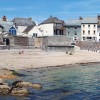
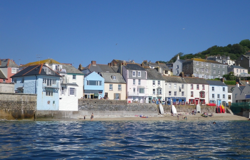
Kingsand Beach, along with its neighbouring beach, Cawsand, boasts sheltered sand and shingle beaches with spectacular views over Plymouth Sound. The beaches are approximately 200 metres wide and are located close to the villages of Cawsand and Kingsand, which are steeped in fishing and smuggling history. The beaches get some shelter from Picklecombe Point to the east and Penlee Point to the west.
The nearby villages of Cawsand and Kingsand offer a range of amenities, including shops, pubs, and restaurants, where visitors can enjoy a meal or drink. The villages are also popular for their excellent walking trails, particularly on the nearby Rame Head.
Cawsand Bay, which is part of the beach, is a popular spot for kayaking, and there is a slipway to launch small craft and dinghys. Visitors can also enjoy snorkelling at Rowse Rocks and Conger Point, located slightly south of Cawsand. The National Trust South West Coastal Path runs behind the beach, offering stunning views of the Rame Head Peninsula.
The beach hosts the traditional May Day festival and parade during the Mayday bank holiday. Visitors can also take the Cawsand Ferry, a 30-minute journey to and from the Barbican Landing Stage in Plymouth. The beach is dog-friendly between 1 October and 30 April, but there are restrictions in the summer. Parking is available at Cawsands Car Park, and visitors can walk down Armada Road to the seafront.
Kingsand Beach is adjacent to the South West Coast Path.
Sand Shingle
| Today |  |
|---|---|
| Chance of rain | 100% |
| Max temperature | 17°C |
| feels like | 18°C |
| Wind 28mph |  |
| Max UV Index |  |
| Tonight |  |
|---|---|
| Chance of rain | 100% |
| Min temperature | 14°C |
| feels like | 13°C |
| Wind 33mph |  |
The tide at Kingsand Beach is currently rising. High tide will be at approximately 6:27 AM, and the next low tide will be at approximately 12:40 PM.
Detailed weather and tides » Campsite
 Toilets
 Shops
Shops
 Slipway
There are pay and display car parks in Cawsand and in Kingsand for 100+ cars each. Cawsand car park is 100 yards from the beach.
There are no restrictions at Kingsand beach but there is a seasonal ban in place at Cawsand beach.
No information available


Water quality not measured here
less than a mile south as the seagull flies, less than a mile by road.
around 2 miles west-northwest as the seagull flies, around 3 miles by road.
around 3 miles west-northwest as the seagull flies, around 4 miles by road.
around 3 miles west-northwest as the seagull flies, around 4 miles by road.
around 4 miles west-northwest as the seagull flies, around 5 miles by road.
around 5 miles west-northwest as the seagull flies, around 7 miles by road.
around 8 miles west-northwest as the seagull flies, around 10 miles by road.
around 8 miles west-northwest as the seagull flies, around 11 miles by road.
around 11 miles west as the seagull flies, around 17 miles by road or 12 miles on foot using coastal paths.
around 11 miles west as the seagull flies, around 17 miles by road or 13 miles on foot using coastal paths.
around 11 miles west as the seagull flies, around 17 miles by road or 13 miles on foot using coastal paths.
around 18 miles west as the seagull flies, around 34 miles by road or 22 miles on foot using coastal paths.
around 3 miles northeast as the seagull flies, around 10 miles by road or 5 miles on foot using coastal paths.
around 3 miles northeast as the seagull flies, around 10 miles by road or 5 miles on foot using coastal paths.
around 4 miles east as the seagull flies, around 16 miles by road or 8 miles on foot using coastal paths.
around 5 miles east-southeast as the seagull flies, around 17 miles by road or 9 miles on foot using coastal paths.
around 9 miles east-southeast as the seagull flies, around 21 miles by road or 14 miles on foot using coastal paths.
around 11 miles east as the seagull flies, around 22 miles by road or 16 miles on foot using coastal paths.
around 11 miles west as the seagull flies, around 18 miles by road or 14 miles on foot using coastal paths.
around 11 miles east as the seagull flies, around 22 miles by road or 16 miles on foot using coastal paths.
Location: Kingsand
Location type: Village
OS Grid: SX435505
Coordinates: 50°20'1"N 4°12'0"W
Mapcode: GBR NT.X6ZK
What 3 Words: period.taking.fast
Coordinates and location codes are for an approximate mid-point of the beach, and may not reflect the best access point or the most popular part of the beach.
Country: England
Local Authority: Cornwall
Parish: Maker-with-Rame
Nearest postcode: PL10 1NF
(for sat-nav purposes only, a beach does not have a postal address!)
Important! Beach information is compiled from a variety of different sources and is correct to the best of our knowledge at the time of compilation. However, information may be incorrectly supplied by our sources or go out of date after publication. BritishBeaches.uk makes no warranty as to the accuracy of any information on this page.