Approximate Location Map
Use two fingers to pan or zoom the map
Use two fingers to pan or zoom the map
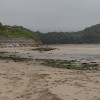
Coastguards Beach is owned by the Flete Estate and is one of three beaches within the estate on the banks of the River Erme. The beach is accessible via a narrow road and slipway with bollards, allowing access for wheelchairs, horse riders, wind surfers, canoes, and surfboards. However, there is limited turning room and no parking available at the slipway.
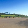
At low tide, Coastguards Beach offers half a mile of firm sand, which shrinks to a small beach at high tide. The beach is a generous expanse of golden sand as the tide goes out, but it becomes a cosy strip of sand as the tide returns.
The name "Coastguards Beach" comes from the row of old coastguard cottages that sit above the beach, watching over the river mouth. The slipway at Coastguards Beach makes it more accessible than the other nearby beaches and is also the recommended low-tide crossing point for the estuary. Visitors can also walk to the beach from neighbouring Mothecombe Beach at low tide.
Dogs are allowed on the beach all year round.
Coastguards Beach is on the South Devon Heritage Coast, and adjacent to the South West Coast Path.
Sand
| Today |  |
|---|---|
| Chance of rain | 100% |
| Max temperature | 16°C |
| feels like | 18°C |
| Wind 22mph |  |
| Max UV Index |  |
| Tonight |  |
|---|---|
| Chance of rain | 100% |
| Min temperature | 13°C |
| feels like | 11°C |
| Wind 26mph |  |
The tide at Coastguards Beach is currently rising. High tide will be at approximately 6:51 PM, and the next low tide will be at approximately 1:02 AM tomorrow.
Detailed weather and tides » Food available
 Toilets
 Litter bins
There is pay parking for 650 cars near the beach.
Dogs are welcome all year round
Cleaned daily during the summer by the Flete Estate
No lifeguard cover at this beach

Water quality not measured here
less than a mile west-southwest as the seagull flies, less than a mile by road.
around 3 miles southeast as the seagull flies, around 12 miles by road or 4 miles on foot using coastal paths.
around 3 miles southeast as the seagull flies, around 14 miles by road or 5 miles on foot using coastal paths.
around 3 miles southeast as the seagull flies, around 14 miles by road or 5 miles on foot using coastal paths.
around 3 miles west-southwest as the seagull flies, around 4 miles by road.
around 3 miles southeast as the seagull flies, around 14 miles by road or 5 miles on foot using coastal paths.
around 3 miles southeast as the seagull flies, around 13 miles by road or 5 miles on foot using coastal paths.
around 8 miles west-northwest as the seagull flies, around 12 miles by road.
around 13 miles east-southeast as the seagull flies, around 22 miles by road or 16 miles on foot using coastal paths.
around 13 miles east as the seagull flies, around 25 miles by road or 16 miles on foot using coastal paths.
around 13 miles east-southeast as the seagull flies, around 23 miles by road or 16 miles on foot using coastal paths.
around 14 miles east as the seagull flies, around 25 miles by road or 17 miles on foot using coastal paths.
around 14 miles east-southeast as the seagull flies, around 24 miles by road or 17 miles on foot using coastal paths.
around 14 miles east-southeast as the seagull flies, around 24 miles by road or 18 miles on foot using coastal paths.
around 15 miles east as the seagull flies, around 28 miles by road or 18 miles on foot using coastal paths.
around 16 miles east as the seagull flies, around 27 miles by road or 19 miles on foot using coastal paths.
around 17 miles east as the seagull flies, around 28 miles by road or 21 miles on foot using coastal paths.
around 21 miles east-northeast as the seagull flies, around 26 miles by road.
around 21 miles east-northeast as the seagull flies, around 27 miles by road.
around 22 miles east-northeast as the seagull flies, around 28 miles by road.
Location: Battisborough Cross
Location type: Rural
OS Grid: SX615476
Coordinates: 50°18'43"N 3°56'44"W
Mapcode: GBR Q6.XS81
What 3 Words: slopes.watchdogs.basic
Coordinates and location codes are for an approximate mid-point of the beach, and may not reflect the best access point or the most popular part of the beach.
County: Devon
Country: England
Local Authority: South Hams
Parish: Holbeton
Nearest postcode: PL8 1LD
(for sat-nav purposes only, a beach does not have a postal address!)
Important! Beach information is compiled from a variety of different sources and is correct to the best of our knowledge at the time of compilation. However, information may be incorrectly supplied by our sources or go out of date after publication. BritishBeaches.uk makes no warranty as to the accuracy of any information on this page.