Approximate Location Map
Use two fingers to pan or zoom the map
Use two fingers to pan or zoom the map
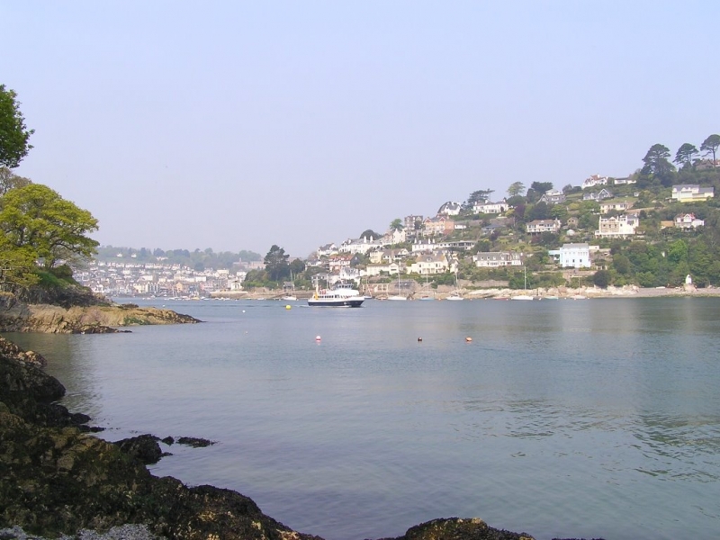
Dartmouth Castle and Sugary Cove are situated at the mouth of the River Dart on the south coast of Devon. The beach is approximately 60 metres wide, backed by cliffs, and overlooked by the historic Dartmouth Castle. The castle is a fortress that has been overlooking the River Dart estuary for centuries, and it also features toilets, a café, and a car park.
The closest parking to Sugary Cove is at Dartmouth Castle, about 100 metres from the beach. From the castle car park, visitors can access the beach via a 5-10 minute walk down a steep path with steps. However, this path may not be suitable for pushchairs or those with mobility problems.
The beach is surrounded by cliffs, rocks, and trees, and it can be easy to miss as it is hidden by trees until visitors are almost on top of it. There are no signposts to the beach, but along the path that leads from the castle, there are a few other coves, including Deadmans Cove and Ladies Cove. The small beach disappears during high tide, so visitors should plan their trip accordingly. Dogs are currently welcome on the beach all year round.
In contrast, Blackpool Sands is a privately managed, award-winning family-friendly beach located in Start Bay, Devon. It is a shingle beach in a sheltered crescent shape, surrounded by green rolling fields and woodland. The water quality is excellent, and lifeguards are on duty in July and August. The beach offers various activities, including sand pits, a bathing raft, kayaks, snorkels, and stand-up paddle boards for hire. Blackpool Sands has a car park directly behind the beach, providing easy access for wheelchairs, pushchairs, and buggies. However, dogs are restricted from March to November.
Sugary Cove is on the South Devon Heritage Coast, and adjacent to the South West Coast Path.
Cove Estuary Sand
| Today |  |
|---|---|
| Chance of rain | % |
| Max temperature | 14°C |
| feels like | 12°C |
| Wind 24mph |  |
| Max UV Index |  |
| Tonight |  |
|---|---|
| Chance of rain | 76% |
| Min temperature | 12°C |
| feels like | 9°C |
| Wind 19mph |  |
The tide at Sugary Cove is currently rising. High tide will be at approximately 6:26 PM, and the next low tide will be at approximately 12:17 AM tomorrow.
Detailed weather and tides » Food available
 Toilets
 Shops
Shops
Car parking by the castle.
No lifeguard cover at this beach


Water quality not measured here
around 2 miles southwest as the seagull flies, around 3 miles by road.
around 2 miles southwest as the seagull flies, around 3 miles by road.
around 4 miles southwest as the seagull flies, around 6 miles by road.
around 5 miles southwest as the seagull flies, around 7 miles by road.
around 6 miles southwest as the seagull flies, around 11 miles by road or 7 miles on foot using coastal paths.
around 7 miles south-southwest as the seagull flies, around 12 miles by road or 9 miles on foot using coastal paths.
around 8 miles south-southwest as the seagull flies, around 13 miles by road or 10 miles on foot using coastal paths.
around 9 miles south-southwest as the seagull flies, around 13 miles by road.
around 12 miles southwest as the seagull flies, around 15 miles by road.
around 12 miles southwest as the seagull flies, around 16 miles by road.
around 12 miles southwest as the seagull flies, around 17 miles by road.
around 14 miles west-southwest as the seagull flies, around 20 miles by road.
around 14 miles west-southwest as the seagull flies, around 20 miles by road.
around 14 miles southwest as the seagull flies, around 21 miles by road.
around 14 miles west-southwest as the seagull flies, around 20 miles by road.
around 14 miles west-southwest as the seagull flies, around 21 miles by road.
around 14 miles west-southwest as the seagull flies, around 19 miles by road.
around 15 miles west-southwest as the seagull flies, around 21 miles by road.
around 15 miles west-southwest as the seagull flies, around 21 miles by road.
around 17 miles west as the seagull flies, around 28 miles by road or 21 miles on foot using coastal paths.
Location: Warfleet
Location type: Rural
OS Grid: SX886500
Coordinates: 50°20'23"N 3°34'0"W
Mapcode: GBR QT.Z182
What 3 Words: crowns.persuade.distanced
Coordinates and location codes are for an approximate mid-point of the beach, and may not reflect the best access point or the most popular part of the beach.
County: Devon
Country: England
Local Authority: South Hams
Parish: Dartmouth
Nearest postcode: TQ6 0JN
(for sat-nav purposes only, a beach does not have a postal address!)
Important! Beach information is compiled from a variety of different sources and is correct to the best of our knowledge at the time of compilation. However, information may be incorrectly supplied by our sources or go out of date after publication. BritishBeaches.uk makes no warranty as to the accuracy of any information on this page.