Approximate Location Map
Use two fingers to pan or zoom the map
Use two fingers to pan or zoom the map
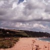
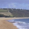
Slapton Sands Monument Beach is situated on the Devon coast between Dartmouth and Kingsbridge. The beach is a good example of a coastal bar, formed by rising sea levels during the last glacial period between 5,000 and 10,000 years ago. It stretches for three miles and is approximately one kilometre wide.
The beach car park is found alongside the A379, and immediately behind the road, is the large freshwater lake called Slapton Ley. Visitors come to the beach to bathe, windsurf, and canoe, and there is an RNLI lifeguard service during the peak summer season. The area also offers some good walks, including the Slapton Ley Nature Trail and the South-West Coastal Path, which passes alongside the beach on the other side of the A379.
This area of the coast is of historical significance. A stone memorial adjacent to the car park commemorates the inhabitants of the nearby villages of the South Hams, who in 1943 were given six weeks’ notice to leave their homes so that the area could be used for troops practicing for the D-Day landings. A Sherman Tank, recovered from around 3/4 mile out to sea, commemorates the ill-fated Exercise Tiger, in April 1944, when hundreds of American servicemen lost their lives in a disastrous “life-like” rehearsal for the Normandy landings in June of that year.
The beach is a family-friendly destination, with a beach front café serving drinks and light snacks, and facilities for holidaymakers. The sea is clean and safe to swim, with water sports to try out including surfing, windsurfing, and canoeing. The beach has RNLI lifeguards on duty during the summer, with flags pointing out the best places to swim. Behind Slapton Sands is the Slapton Ley National Nature Reserve, which attracts nature lovers from far and wide to enjoy the wildlife around the freshwater lake.
Slapton Sands is a dog-friendly beach, allowing dogs on the beach throughout the year. There is parking and a bus stop by the Slapton Monument on the sea front, just off Sands Road.
Slapton Sands Monument Beach is on the South Devon Heritage Coast, and adjacent to the South West Coast Path.
Sand Shingle
| Today |  |
|---|---|
| Chance of rain | 99% |
| Max temperature | 15°C |
| feels like | 15°C |
| Wind 21mph |  |
| Max UV Index |  |
| Tonight |  |
|---|---|
| Chance of rain | % |
| Min temperature | 10°C |
| feels like | 13°C |
| Wind 18mph | |
The tide at Slapton Sands Monument Beach is currently rising. High tide will be at approximately 4:33 PM, and the next low tide will be at approximately 10:43 PM.
 Today's air pollution levels are forecast to be Low
 Campsite
 Toilets
 Litter bins
Three car parks exist, with a total of 500 parking spaces, 5 disabled spaces in the middle, by the tank monument.
Dogs are allowed.
Cleaned daily during the summer.

Daily - 9th July - 4th September


Water quality not measured here
less than a mile north-northeast as the seagull flies, just over a mile by road.
just over a mile south-southwest as the seagull flies, around 5 miles by road or 2 miles on foot using coastal paths.
around 2 miles south-southwest as the seagull flies, around 5 miles by road or 3 miles on foot using coastal paths.
around 3 miles northeast as the seagull flies, around 4 miles by road.
around 3 miles northeast as the seagull flies, around 4 miles by road.
around 4 miles south as the seagull flies, around 7 miles by road or 4 miles on foot using coastal paths.
around 5 miles south as the seagull flies, around 7 miles by road or 5 miles on foot using coastal paths.
around 5 miles northeast as the seagull flies, around 7 miles by road.
around 7 miles southwest as the seagull flies, around 9 miles by road.
around 7 miles southwest as the seagull flies, around 9 miles by road.
around 7 miles southwest as the seagull flies, around 10 miles by road.
around 10 miles west as the seagull flies, around 13 miles by road.
around 10 miles west as the seagull flies, around 14 miles by road.
around 10 miles west-southwest as the seagull flies, around 14 miles by road.
around 10 miles west as the seagull flies, around 13 miles by road.
around 10 miles west-southwest as the seagull flies, around 15 miles by road.
around 10 miles west as the seagull flies, around 15 miles by road.
around 13 miles west as the seagull flies, around 25 miles by road or 16 miles on foot using coastal paths.
around 13 miles west as the seagull flies, around 25 miles by road or 16 miles on foot using coastal paths.
around 14 miles west as the seagull flies, around 25 miles by road or 17 miles on foot using coastal paths.
Location: Slapton
Location type: Rural
OS Grid: SX829442
Coordinates: 50°17'12"N 3°38'40"W
Mapcode: GBR QP.9K92
What 3 Words: intruding.buddy.mass
Coordinates and location codes are for an approximate mid-point of the beach, and may not reflect the best access point or the most popular part of the beach.
County: Devon
Country: England
Local Authority: South Hams
Parish: Slapton
Nearest postcode: TQ7 2QW
(for sat-nav purposes only, a beach does not have a postal address!)
Important! Beach information is compiled from a variety of different sources and is correct to the best of our knowledge at the time of compilation. However, information may be incorrectly supplied by our sources or go out of date after publication. BritishBeaches.uk makes no warranty as to the accuracy of any information on this page.