Approximate Location Map
Use two fingers to pan or zoom the map
Use two fingers to pan or zoom the map
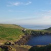
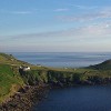
Tregaseal Beach is situated just to the south of Cape Cornwall, on the South West Coast Path. The beach is a favoured destination for walkers due to its spectacular sea views.
Nearby Priest Cove, located at Cape Cornwall, is a tiny fishing cove featuring the remains of a tin mine chimney high on the headland, overlooking the rocky beach. The cove also boasts rock pools at low tide, making it a magical location for a dip, with the twin rock (The Brisons) visible in the distance. Visitors can enjoy excellent views and embark on wonderful cliff walks.
Tregaseal Beach is on the Penwith Heritage Coast, and adjacent to the South West Coast Path.
Sand Pebbles
| Tonight |  |
|---|---|
| Chance of rain | 100% |
| Min temperature | 12°C |
| feels like | 11°C |
| Wind 24mph |  |
| Tomorrow |
 |
|---|---|
| Chance of rain | 100% |
| Max temperature | 16°C |
| feels like | 13°C |
| Wind 34mph |  |
| Max UV Index |  |
The tide at Tregaseal Beach is currently falling. Low tide will be at approximately 11:28 PM, and the next high tide will be at approximately 5:05 AM tomorrow.
Detailed weather and tides »There is a small parking bay just above the beach and a National Trust car park to the south at Cape Cornwall.
No lifeguard cover at this beach

Water quality not measured here
less than a mile south-southwest as the seagull flies, around 2 miles by road or just over a mile on foot using coastal paths.
less than a mile south as the seagull flies, around 2 miles by road.
around 3 miles northeast as the seagull flies, around 6 miles by road or 4 miles on foot using coastal paths.
around 3 miles south as the seagull flies, around 6 miles by road or 4 miles on foot using coastal paths.
around 4 miles south as the seagull flies, around 6 miles by road.
around 5 miles south as the seagull flies, around 10 miles by road or 7 miles on foot using coastal paths.
around 5 miles northeast as the seagull flies, around 9 miles by road or 7 miles on foot using coastal paths.
around 7 miles south-southeast as the seagull flies, around 10 miles by road.
around 7 miles northeast as the seagull flies, around 11 miles by road.
around 7 miles south-southeast as the seagull flies, around 10 miles by road.
around 7 miles east-southeast as the seagull flies, around 8 miles by road.
around 7 miles northeast as the seagull flies, around 12 miles by road.
around 8 miles east as the seagull flies, around 9 miles by road.
around 8 miles east as the seagull flies, around 10 miles by road.
around 8 miles southeast as the seagull flies, around 12 miles by road.
around 8 miles east-southeast as the seagull flies, around 10 miles by road.
around 8 miles east as the seagull flies, around 10 miles by road.
around 10 miles east as the seagull flies, around 12 miles by road.
around 10 miles east as the seagull flies, around 12 miles by road.
around 11 miles east-northeast as the seagull flies, around 17 miles by road or 13 miles on foot using coastal paths.
Location: Botallack
Location type: Rural
OS Grid: SW355322
Coordinates: 50°7'53"N 5°42'6"W
Mapcode: GBR DX9B.H3V
What 3 Words: unhappy.promotes.powering
Coordinates and location codes are for an approximate mid-point of the beach, and may not reflect the best access point or the most popular part of the beach.
Country: England
Local Authority: Cornwall
Parish: St. Just
Nearest postcode: TR19 7RG
(for sat-nav purposes only, a beach does not have a postal address!)
Important! Beach information is compiled from a variety of different sources and is correct to the best of our knowledge at the time of compilation. However, information may be incorrectly supplied by our sources or go out of date after publication. BritishBeaches.uk makes no warranty as to the accuracy of any information on this page.